


In his latest entry in KCET's "Laws That Shaped LA" Series, Jeremy Rosenberg looks at the impact that the Functional Classification system has had on the urban form of Los Angeles and cities throughout the country since its adoption in 1973.
With the help of John Norquist, President and CEO of The Congress for the New Urbanism, who nominated the "Functional Classification Guidelines" for inclusion in Rosenberg's series, the reporter looks at how the "deceptively innocuous-sounding" guidelines helped advance sprawl and destroy urban landscapes by single-mindedly focusing the functionality of streets around accommodating auto movement.
"A successful street, Norquist says, must serve as: a path on which people travel, a place that facilitates the buying and selling of goods and services, and a public gathering spot." However, the Functional Classification system, which was "spelled out in a 1968 Department of Transportation study manual and then adopted into law as part of the Federal-Aid Highway Act of 1973," led public agencies to "focus on -- and fund accordingly -- street projects that put movement first..."
The result? "Sprawl happened. Interstates went right through cities, not around them. Significantly wider surface streets were constructed. Historic and other older buildings were sacrificed for more asphalt lanes. Urban cores split and sputtered. Commerce stalled. Tax receipts declined. People's daily lives intersected less. Suburban big box retail replaced mixed-use Main Streets. Life in less sustainable suburbia started to make sense. Populations fled."
So what is the antidote to movement? Congestion, as Norquist argued in a recent op-ed for Planetizen. "[E]ven at its worst, moving slower on a narrower road through a happening and engaged city far outweighs the alternative that the Functional Classification has for so long promoted."
FULL STORY: Sprawl: What Happens When You Legislate Against Vibrant Streets

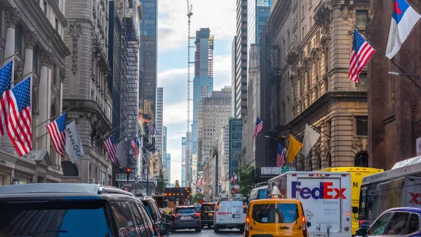
NYC Congestion Pricing: Still Working
10 million fewer vehicles entered the congestion pricing zone in the first six months of the program than last year, while pedestrian fatalities are at ‘historic lows.’

Judge Extends NYC Congestion Pricing Through at Least June 9
A federal judge halted the Trump administration’s effort to kill the program, which remains in limbo as a lawsuit filed by the MTA moves forward.

Maui's Vacation Rental Debate Turns Ugly
Verbal attacks, misinformation campaigns and fistfights plague a high-stakes debate to convert thousands of vacation rentals into long-term housing.

Planetizen Federal Action Tracker
A weekly monitor of how Trump’s orders and actions are impacting planners and planning in America.

In Urban Planning, AI Prompting Could be the New Design Thinking
Creativity has long been key to great urban design. What if we see AI as our new creative partner?

Portland Raises Parking Fees to Pay for Street Maintenance
The city is struggling to bridge a massive budget gap at the Bureau of Transportation, which largely depleted its reserves during the Civd-19 pandemic.

Spokane Mayor Introduces Housing Reforms Package
Mayor Lisa Brown’s proposals include deferring or waiving some development fees to encourage more affordable housing development.

Houston Mayor Kills Another Bike Lane
The mayor rejected a proposed bike lane in the Montrose district in keeping with his pledge to maintain car lanes.
Urban Design for Planners 1: Software Tools
This six-course series explores essential urban design concepts using open source software and equips planners with the tools they need to participate fully in the urban design process.
Planning for Universal Design
Learn the tools for implementing Universal Design in planning regulations.
Gallatin County Department of Planning & Community Development
Heyer Gruel & Associates PA
JM Goldson LLC
City of Camden Redevelopment Agency
City of Astoria
Transportation Research & Education Center (TREC) at Portland State University
Jefferson Parish Government
Camden Redevelopment Agency
City of Claremont