


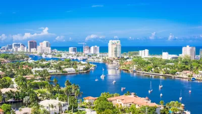
In an astonishing interactive graphic and accompanying opinion piece, Benjamin Strauss and Roberr Kopp outline several likely scenarios for the impact of rising seas on America's urban areas. New Orleans and Miami Beach could be completely submerged.
Even the most conservative estimates for rising sea levels (five feet at a minimum) would almost completely submerge New Orleans, Miami Beach, and sizable portions of other American cities without engineered protection. With "[m]ore than six million Americans [living] on land less than five feet above the local high tide," the best case for the impact of a warming planet on coastal communities will be substantial.
However, present trends seem to indicate a more dire scenario, say Strauss and Kopp. "If instead we make moderate shifts in energy and industry — using the kinds of targets that nations have contemplated in international talks but have failed to pursue — sea level could still climb past 12 feet just after 2300. It is hard to imagine what measures might allow many of our great coastal cities to survive a 12-foot increase." In a stunning infographic accompanying the article you can explore the impact of various scenarios (5, 12, and 25 ft sea level rises) on America's coastal cities.
Strauss and Kopp outline the two-pronged approach that will be necessary to protect our developed lands from a historic warming phase. "There are two basic ways to protect ourselves from sea level rise: reduce it by cutting pollution, or prepare for it by defense and retreat. To do the job, we must do both."
"We have lost our chance for complete prevention; and preparation alone, without slowing emissions, would — sooner or later — turn our coastal cities into so many Atlantises."
FULL STORY: What Could Disappear

Hurricane Ian Puts Renewed Focus on Florida's Barrier Islands
Ian did not impact Southeast Florida, but coastal residents there took notice of the state's deadliest hurricane since 1935 that devastated much of Southwest Florida last month, particularly the barrier islands off the Gulf Coast.
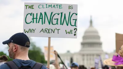
How Cities Can Curb Climate Change and Protect Vulnerable Residents
A new U.N. report urges cities to upgrade their infrastructure to bolster climate resilience and build more sustainable, climate-friendly places.
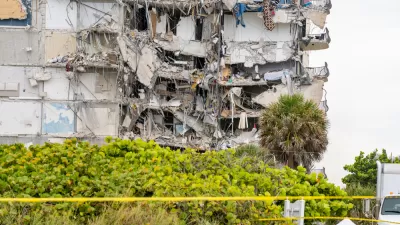
The Problem With Miami Beach's High-Rises
Last year's Miami Beach condo collapse could portend more tragedy to come if developers don't address the risks of aging buildings and climate change.

Planetizen Federal Action Tracker
A weekly monitor of how Trump’s orders and actions are impacting planners and planning in America.

Restaurant Patios Were a Pandemic Win — Why Were They so Hard to Keep?
Social distancing requirements and changes in travel patterns prompted cities to pilot new uses for street and sidewalk space. Then it got complicated.

Map: Where Senate Republicans Want to Sell Your Public Lands
For public land advocates, the Senate Republicans’ proposal to sell millions of acres of public land in the West is “the biggest fight of their careers.”

Maui's Vacation Rental Debate Turns Ugly
Verbal attacks, misinformation campaigns and fistfights plague a high-stakes debate to convert thousands of vacation rentals into long-term housing.

San Francisco Suspends Traffic Calming Amidst Record Deaths
Citing “a challenging fiscal landscape,” the city will cease the program on the heels of 42 traffic deaths, including 24 pedestrians.

California Homeless Arrests, Citations Spike After Ruling
An investigation reveals that anti-homeless actions increased up to 500% after Grants Pass v. Johnson — even in cities claiming no policy change.
Urban Design for Planners 1: Software Tools
This six-course series explores essential urban design concepts using open source software and equips planners with the tools they need to participate fully in the urban design process.
Planning for Universal Design
Learn the tools for implementing Universal Design in planning regulations.
Heyer Gruel & Associates PA
JM Goldson LLC
Custer County Colorado
City of Camden Redevelopment Agency
City of Astoria
Transportation Research & Education Center (TREC) at Portland State University
Camden Redevelopment Agency
City of Claremont
Municipality of Princeton (NJ)