


Noah Kazis considers three success stories for public space in Mexico City, taking streets back from both automobiles and – believe it or not – street vendors.
Authorities in Mexico City have given three streets a major facelift, closing off traffic to cars and handing street life back to pedestrians.
The first, Calle Regina, had bigger problems to deal with than vehicular traffic. The street was crowded with vendors that, according to authorities, were affiliated with gangs. "As the administration of Mayor Marcelo Ebrard cleared the area, authorities found caches of drugs and guns," writes Kazis. "Different colored tarps announced which gangs protected each vendor. Only after removing the vendors could officials turn their attention to making Calle Regina car free."
Nearer the zócalo, or public square, on Calle Francisco I. Madero, the City's Public Space Authority faced a different challenge: business owners concerned that restricting traffic would cut into business. The Authority's head, Daniel Escotto, pleaded with the local chamber of commerce: "Let me just have one day, with cones," he recalls. When the program began, Calle Madero was closed once a week, on Mondays. Within two weeks, it was Tuesdays, too. Just three months later, the street was repaved to eliminate its curbs, in a gesture of commitment to its new, pedestrian-only status.
Lastly, to celebrate the bicentennial of the Mexican Revolution, officials approved pedestrian-friendly improvements to the monumental Plaza de la República. "Sidewalks were widened and beautified with new street furniture and plantings. Plaza space once given over to car parking was reclaimed, creating room for amenities like a new fountain."
The next step, according to Escotto, is to remove all four lanes of vehicular traffic surrounding the Plaza by the end of 2012, dedicating the space exclusively to pedestrians.
FULL STORY: How Mexico City Fought and Cajoled to Reclaim Streets for Pedestrians


Mexico City Raises Mobility, Public Works Budget Ahead of World Cup
The Mexican capital plans to improve mobility to its major sports venues and invest in public works and infrastructure.
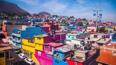
Mexico City Aerial ‘Cablebus’ Provides Key Connection to Peripheral Neighborhoods
Unlike many aerial gondolas, Mexico City’s Cablebus is largely used by commuters and residents from communities farther from the city center.
Rooftop Solar on Mexico City Market to Power 300 Transit Buses
A solar project atop a massive food market will provide electricity to Mexico City's public transit buses.

Planetizen Federal Action Tracker
A weekly monitor of how Trump’s orders and actions are impacting planners and planning in America.

Map: Where Senate Republicans Want to Sell Your Public Lands
For public land advocates, the Senate Republicans’ proposal to sell millions of acres of public land in the West is “the biggest fight of their careers.”

Restaurant Patios Were a Pandemic Win — Why Were They so Hard to Keep?
Social distancing requirements and changes in travel patterns prompted cities to pilot new uses for street and sidewalk space. Then it got complicated.

Platform Pilsner: Vancouver Transit Agency Releases... a Beer?
TransLink will receive a portion of every sale of the four-pack.

Toronto Weighs Cheaper Transit, Parking Hikes for Major Events
Special event rates would take effect during large festivals, sports games and concerts to ‘discourage driving, manage congestion and free up space for transit.”

Berlin to Consider Car-Free Zone Larger Than Manhattan
The area bound by the 22-mile Ringbahn would still allow 12 uses of a private automobile per year per person, and several other exemptions.
Urban Design for Planners 1: Software Tools
This six-course series explores essential urban design concepts using open source software and equips planners with the tools they need to participate fully in the urban design process.
Planning for Universal Design
Learn the tools for implementing Universal Design in planning regulations.
Heyer Gruel & Associates PA
JM Goldson LLC
Custer County Colorado
City of Camden Redevelopment Agency
City of Astoria
Transportation Research & Education Center (TREC) at Portland State University
Camden Redevelopment Agency
City of Claremont
Municipality of Princeton (NJ)