


A new land use study based on the 2008 "comp plans" data reveals a significant shift toward mixed-use and transit-oriented developments (TODs) in the Twin Cities seven-county metro area.
The 2030 projection for mixed-use in the Minneapolis-Saint Paul region is 55,000 acres, which represents a huge jump from less than 5,700 acres in 2010. Similarly, the 2030 land use estimate for "transitway corridor" is reported at 22.7%, also showing a marked increase from 8.4% in 2010.
There is a "statistically significant trend of more people in the seven-county metro region moving closer to the central core of cities and to more accessible transit options in higher-density areas. The land-use data also project a fast acceleration of the shift in the next 20 years," writes Bill Clements for Finance and Commerce.
"As we come out of this recession, it will be very interesting to see how the market responds. Is that a permanent shift toward more permanent attached and smaller single-family detached housing?," asks the Met Council analyst John Kari in the article.
FULL STORY: Culture change or fad? Twin Cities population shifts toward central core


Maryland Awards $1.25M in TOD-Related Grants
The state’s DOT is funding projects that prepare sites around transit stations for future mixed-use development and housing.
Judge Rules in Favor of Massachusetts TOD Law
The court rejected an argument that the MBTA Communities law, which requires zoning for multifamily housing, is an “unfunded mandate.”

High Housing Costs Driving Down Transit Ridership in LA
When neighborhoods gentrify and displace lower-income residents, transit ridership suffers, new research shows.

Maui's Vacation Rental Debate Turns Ugly
Verbal attacks, misinformation campaigns and fistfights plague a high-stakes debate to convert thousands of vacation rentals into long-term housing.

Planetizen Federal Action Tracker
A weekly monitor of how Trump’s orders and actions are impacting planners and planning in America.

San Francisco Suspends Traffic Calming Amidst Record Deaths
Citing “a challenging fiscal landscape,” the city will cease the program on the heels of 42 traffic deaths, including 24 pedestrians.

Defunct Pittsburgh Power Plant to Become Residential Tower
A decommissioned steam heat plant will be redeveloped into almost 100 affordable housing units.

Trump Prompts Restructuring of Transportation Research Board in “Unprecedented Overreach”
The TRB has eliminated more than half of its committees including those focused on climate, equity, and cities.

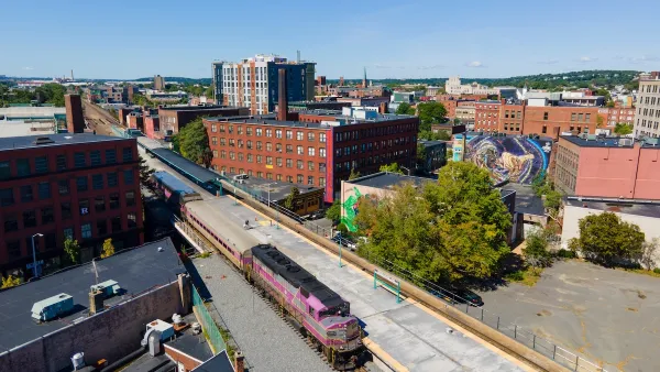
Amtrak Rolls Out New Orleans to Alabama “Mardi Gras” Train
The new service will operate morning and evening departures between Mobile and New Orleans.
Urban Design for Planners 1: Software Tools
This six-course series explores essential urban design concepts using open source software and equips planners with the tools they need to participate fully in the urban design process.
Planning for Universal Design
Learn the tools for implementing Universal Design in planning regulations.
Heyer Gruel & Associates PA
JM Goldson LLC
Custer County Colorado
City of Camden Redevelopment Agency
City of Astoria
Transportation Research & Education Center (TREC) at Portland State University
Jefferson Parish Government
Camden Redevelopment Agency
City of Claremont