


Per Square Mile recount the history of Cahokia, a Mississipian settlement that was the biggest city in America from about 1250 to 1800.
"The city's inhabitants built over 100 mounds, eighty of which remain. One of them still towers 92 feet over the surrounding fields and is easily visible from the scratched postage-stamp windows of St. Louis' Gateway Arch. With somewhere between 10,000 to 15,000 people, it held the record for the largest American city until around 1800, when Philadelphia finally overtook it.
With that many people crammed into just under three-quarters of a square mile-the estimated size of the city's neighborhoods-it may sound like Cahokia was as cramped as the slums of Upton Sinclair's Chicago. But it probably didn't feel that way. Sweeping plazas and towering mounds added nearly three square miles of open space, keeping much of the city open and airy like Baron Haussmann's Paris. Yet unlike the city on the Seine's astronomical modern density of 58,890 people per square mile, Cahokia's population lived at a positively suburban 1,000 to 1,500 people per square mile, thanks to the plazas and mounds."
Based on archaeological excavations, just 20% of the city's land was dedicated to housing.
FULL STORY: Density in the pre-Columbian United States: A look at Cahokia

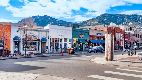
Boulder Eliminates Parking Minimums Citywide
Officials estimate the cost of building a single underground parking space at up to $100,000.
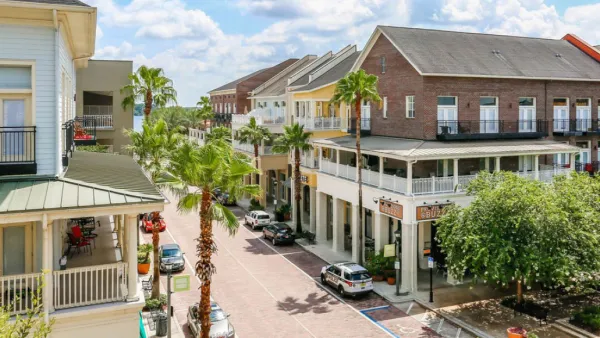
Orange County, Florida Adopts Largest US “Sprawl Repair” Code
The ‘Orange Code’ seeks to rectify decades of sprawl-inducing, car-oriented development.
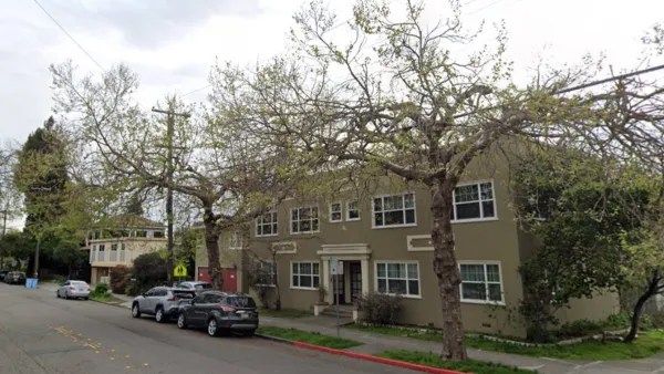
Berkeley Approves ‘Middle Housing’ Ordinance
The city that invented single-family zoning is finally reckoning with its history of exclusion.

Maui's Vacation Rental Debate Turns Ugly
Verbal attacks, misinformation campaigns and fistfights plague a high-stakes debate to convert thousands of vacation rentals into long-term housing.

Planetizen Federal Action Tracker
A weekly monitor of how Trump’s orders and actions are impacting planners and planning in America.

San Francisco Suspends Traffic Calming Amidst Record Deaths
Citing “a challenging fiscal landscape,” the city will cease the program on the heels of 42 traffic deaths, including 24 pedestrians.

Defunct Pittsburgh Power Plant to Become Residential Tower
A decommissioned steam heat plant will be redeveloped into almost 100 affordable housing units.

Trump Prompts Restructuring of Transportation Research Board in “Unprecedented Overreach”
The TRB has eliminated more than half of its committees including those focused on climate, equity, and cities.

Amtrak Rolls Out New Orleans to Alabama “Mardi Gras” Train
The new service will operate morning and evening departures between Mobile and New Orleans.
Urban Design for Planners 1: Software Tools
This six-course series explores essential urban design concepts using open source software and equips planners with the tools they need to participate fully in the urban design process.
Planning for Universal Design
Learn the tools for implementing Universal Design in planning regulations.
Heyer Gruel & Associates PA
JM Goldson LLC
Custer County Colorado
City of Camden Redevelopment Agency
City of Astoria
Transportation Research & Education Center (TREC) at Portland State University
Jefferson Parish Government
Camden Redevelopment Agency
City of Claremont