


Governor's Island is likely the next major waterfront area in New York City to be converted into a public space. Designers and planners are starting to think about what form it could and should take.
Brian Davis talks with Adriaan Geuze of the landscape architecture and urban design firm West 8 about a proposal for the future of the space.
"Brian Davis: The idea of a new public park on Governors Island has generated a lot of excitement in New York City. Every year more and more people visit, and recently Mayor Bloomberg said that the Island "can become one of the world's greatest public places, and we're committed to making it happen." How do you see the Island's potential right now?
Adriaan Geuze: I like to think of Governors Island in terms of the narrative of New York. Public life in New York City has traditionally been focused not out to the sea but in on the land - the view has been more inward than outward regarding public space. For centuries the water's edge was given over to infrastructure, like highways, and to shipping and industry. But now the city's political leadership is looking to the waterfront as the location for the next generation of public spaces, of public parks. So this is new, and it's a great moment in the city's history. It promises to define our time, to make it distinct from earlier eras."
FULL STORY: The New Public Landscapes of Governors Island: An Interview with Adriaan Geuze

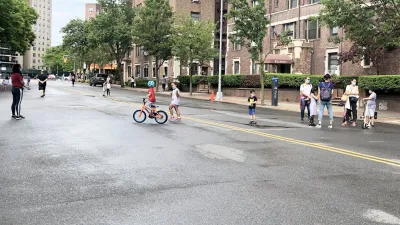
NYC Open Streets Organizers Call for City Support
The number of open streets projects has dropped year after year as volunteer groups struggle to fund and staff them.
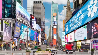
NYC Officials Announce Broadway Pedestrianization Project
Two blocks of the marquee street will become mostly car-free public spaces.
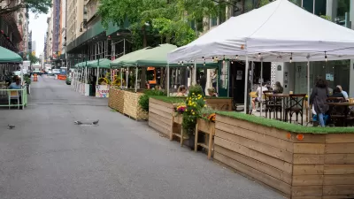
NYC Announces $30M for Open Streets Projects
The funding is designed to support open streets and public space projects in underresourced neighborhoods.

Maui's Vacation Rental Debate Turns Ugly
Verbal attacks, misinformation campaigns and fistfights plague a high-stakes debate to convert thousands of vacation rentals into long-term housing.

Planetizen Federal Action Tracker
A weekly monitor of how Trump’s orders and actions are impacting planners and planning in America.

In Urban Planning, AI Prompting Could be the New Design Thinking
Creativity has long been key to great urban design. What if we see AI as our new creative partner?

Florida Seniors Face Rising Homelessness Risk
High housing costs are pushing more seniors, many of them on a fixed income, into homelessness.

Massachusetts Budget Helps Close MBTA Budget Gap
The budget signed by Gov. Maura Healey includes $470 million in MBTA funding for the next fiscal year.

Milwaukee Launches Vision Zero Plan
Seven years after the city signed its Complete Streets Policy, the city is doubling down on its efforts to eliminate traffic deaths.
Urban Design for Planners 1: Software Tools
This six-course series explores essential urban design concepts using open source software and equips planners with the tools they need to participate fully in the urban design process.
Planning for Universal Design
Learn the tools for implementing Universal Design in planning regulations.
Gallatin County Department of Planning & Community Development
Heyer Gruel & Associates PA
JM Goldson LLC
City of Camden Redevelopment Agency
City of Astoria
Transportation Research & Education Center (TREC) at Portland State University
Jefferson Parish Government
Camden Redevelopment Agency
City of Claremont