


Sharrows are a great way to give cyclists access to the full traffic lane without designating a bike lane, but as this case in San Francisco illustrates, not all applications are good ones. The presence of a bus-only lane created the problem.
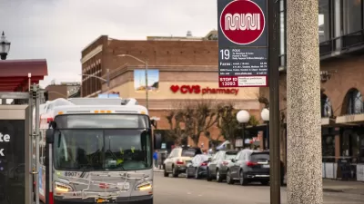
Sharrows, or 'shared lane' signage, are applied on traffic lanes to clearly mark these lanes to cyclists and motorists that both have access to them. Generally they are used on narrow curb lanes where vehicle parking exists to prevent cyclists from biking to closely to the parked cars so as to prevent being 'doored'. However, the far-right, bus-only lanes on Post and Sutter made that impossible, so the San Francisco Municipal Transportation Agency (SFMTA) chose to sharrow the center lane as cyclists are not legally allowed to use lanes exclusive to buses.
"On two main thoroughfares in and out of downtown - Post and Sutter Streets between Van Ness Avenue and Union Square - the transportation agency has placed (sharrows) in the middle of busy, one-way streets. This puts cyclists in the center lane of three, surrounded by fast cars on all sides.
Joshua Citrak, an avid cyclist with 10 years' experience on San Francisco streets, pedaled the route at the request of The Bay Citizen." See his excellent video of biking the hills in urban San Francisco.
From Streetsblog SF (6/25/10): New Sharrows on Sutter and Post Streets Not Popular with Cyclists
New sharrows have been placed on the center lanes of Post and Sutter, but "drivers often zoom by at alarming speeds, breaking the 25 mile an hour speed limit, narrowly avoiding crashes, and treating the three-lane arterial like a highway...
The SFMTA recently installed the sharrows on both Sutter and Post Streets (Bicycle Route 16) as part of its Bike Plan directive to add 75 miles of new sharrows on bike routes across the city."
Thanks to SF Streetsblog
FULL STORY: New San Francisco Bike Lanes Too Dangerous to Use (Plus: Video)


Opinion: San Francisco Needs a Well-Funded Transit System
Muni ridership is above pre-pandemic levels on some lines. Why is the agency still considering service cuts?
San Francisco Muni Sees Highest Ridership Since Start of Pandemic
The SFMTA is improving service at off-peak hours and on weekends to accommodate new travel patterns that rely less on weekday commuters. Ridership has increased accordingly.
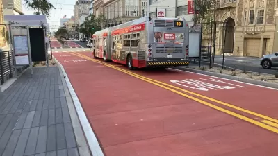
Van Ness BRT Speeds Travel by 36%, Earns Silver Designation
The San Francisco rapid bus line is making transit on the corridor more reliable and reducing traffic crashes and congestion.

Maui's Vacation Rental Debate Turns Ugly
Verbal attacks, misinformation campaigns and fistfights plague a high-stakes debate to convert thousands of vacation rentals into long-term housing.

Planetizen Federal Action Tracker
A weekly monitor of how Trump’s orders and actions are impacting planners and planning in America.

San Francisco Suspends Traffic Calming Amidst Record Deaths
Citing “a challenging fiscal landscape,” the city will cease the program on the heels of 42 traffic deaths, including 24 pedestrians.

Defunct Pittsburgh Power Plant to Become Residential Tower
A decommissioned steam heat plant will be redeveloped into almost 100 affordable housing units.

Trump Prompts Restructuring of Transportation Research Board in “Unprecedented Overreach”
The TRB has eliminated more than half of its committees including those focused on climate, equity, and cities.

Amtrak Rolls Out New Orleans to Alabama “Mardi Gras” Train
The new service will operate morning and evening departures between Mobile and New Orleans.
Urban Design for Planners 1: Software Tools
This six-course series explores essential urban design concepts using open source software and equips planners with the tools they need to participate fully in the urban design process.
Planning for Universal Design
Learn the tools for implementing Universal Design in planning regulations.
Heyer Gruel & Associates PA
JM Goldson LLC
Custer County Colorado
City of Camden Redevelopment Agency
City of Astoria
Transportation Research & Education Center (TREC) at Portland State University
Jefferson Parish Government
Camden Redevelopment Agency
City of Claremont