


Next American City talks with urban designer and bicycle planner Mike Lydon about cycling, ciclovias, and open streets.
Lydon is the Founding Principal of The Street Plans Collaborative, an urban planning, advocacy and design firm, and is also a blooger on Planetizen Interchange.
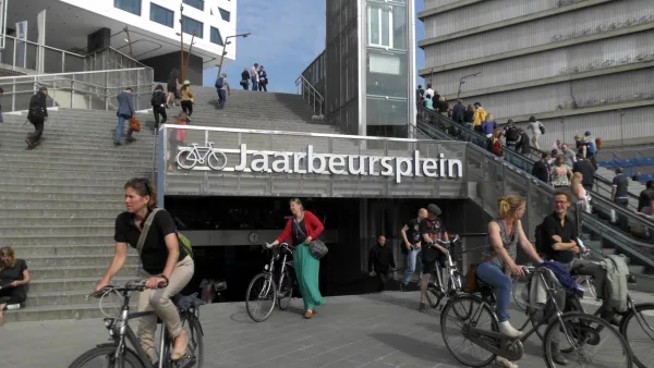
"City / Culture: You've compiled a timeline that shows when different North American cities adapted open streets initiatives. The timeline shows 35 cities and one state (Kentucky) having added events since 2008, as compared to seven cities from 1970-2007. What changed?
Mike Lydon: There are lots of converging issues. One, the repopulating of cities, and the desire of people interested in living in cities to make them more livable. There's a whole public health side of things – getting more active and healthy walking and biking opportunities plays into that. You see community activists reclaiming the streets from automobiles, making them more multi-purpose, so they can meet more needs.
When a city starts setting a new precedent for an exciting and very significant solution to a problem, a lot of cities tend to follow. We call those early cities, "pattern cities." Bogotá is a pattern city in South America, and other cities follow suit, and that wisdom filtered up to North America. Now you see many more overt efforts and intents to integrate bicycling and walking into initiatives throughout North American cities."
FULL STORY: City / Culture: A Bike + Planning Conversation with Mike Lydon


How Bike-Friendly Is Your City?
PeopleForBikes just released its annual rankings.
Supporting Cycling Takes More Than Just Bike Lanes
Safe, protected bike lanes are a key part of a city’s bike infrastructure — but secure parking, e-bike charging, and other amenities can also influence people’s shift to cycling.

The Rippling Effects of Bike-to-Work Subsidies
A European movement to incentivize people to commute by bicycle is changing travel patterns and making mobility more sustainable.

Maui's Vacation Rental Debate Turns Ugly
Verbal attacks, misinformation campaigns and fistfights plague a high-stakes debate to convert thousands of vacation rentals into long-term housing.

Planetizen Federal Action Tracker
A weekly monitor of how Trump’s orders and actions are impacting planners and planning in America.

San Francisco Suspends Traffic Calming Amidst Record Deaths
Citing “a challenging fiscal landscape,” the city will cease the program on the heels of 42 traffic deaths, including 24 pedestrians.

Defunct Pittsburgh Power Plant to Become Residential Tower
A decommissioned steam heat plant will be redeveloped into almost 100 affordable housing units.

Trump Prompts Restructuring of Transportation Research Board in “Unprecedented Overreach”
The TRB has eliminated more than half of its committees including those focused on climate, equity, and cities.

Amtrak Rolls Out New Orleans to Alabama “Mardi Gras” Train
The new service will operate morning and evening departures between Mobile and New Orleans.
Urban Design for Planners 1: Software Tools
This six-course series explores essential urban design concepts using open source software and equips planners with the tools they need to participate fully in the urban design process.
Planning for Universal Design
Learn the tools for implementing Universal Design in planning regulations.
Heyer Gruel & Associates PA
JM Goldson LLC
Custer County Colorado
City of Camden Redevelopment Agency
City of Astoria
Transportation Research & Education Center (TREC) at Portland State University
Jefferson Parish Government
Camden Redevelopment Agency
City of Claremont