


Ron Ringen has logged more than 1,400 animals for a roadkill project. "I'm almost a fanatic with it," he said. "You get hooked."
The New York Times reports on fanatical roadkill trackers:
"While Mr. Ringen's friends goad him with nicknames like
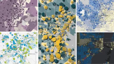
Doctor Roadkill," he is not alone in his peculiar pursuit. Hundreds of volunteers collect and upload roadkill data to the California Roadkill Observation System, a mapping Web site built by researchers at the University of California, Davis, to better understand where and why cars strike animals.
The roadkill maps give researchers a better understanding of the environmental impacts of roads."
Researchers pour this information into GIS models to find locations where animals cross most frequently and recommend that safety measures be taken to protect them at those locations.
Thanks to Andrew Watanabe
FULL STORY: Mapping Traffic’s Toll on Wildlife

Transit and Car-Sharing Get Boost from Technology
The increase in transit ridership and carsharing isn't just due to the rise in gas prices, but also the rise in new technologies providing up-to-the-minute reports on location and ride availability.

Trump Cuts Decimate Mapping Agency
The National Geodetic Survey maintains and updates critical spatial reference systems used extensively in both the public and private sectors.
Explore US Demographics With the New ACS Atlas Collection
Esri's new ACS Atlas Collection offers interactive applications that visualize the latest U.S. demographic and socio-economic data, enabling users to explore over 175 curated web maps across various thematic areas.

Maui's Vacation Rental Debate Turns Ugly
Verbal attacks, misinformation campaigns and fistfights plague a high-stakes debate to convert thousands of vacation rentals into long-term housing.

Planetizen Federal Action Tracker
A weekly monitor of how Trump’s orders and actions are impacting planners and planning in America.

San Francisco Suspends Traffic Calming Amidst Record Deaths
Citing “a challenging fiscal landscape,” the city will cease the program on the heels of 42 traffic deaths, including 24 pedestrians.

Defunct Pittsburgh Power Plant to Become Residential Tower
A decommissioned steam heat plant will be redeveloped into almost 100 affordable housing units.

Trump Prompts Restructuring of Transportation Research Board in “Unprecedented Overreach”
The TRB has eliminated more than half of its committees including those focused on climate, equity, and cities.

Amtrak Rolls Out New Orleans to Alabama “Mardi Gras” Train
The new service will operate morning and evening departures between Mobile and New Orleans.
Urban Design for Planners 1: Software Tools
This six-course series explores essential urban design concepts using open source software and equips planners with the tools they need to participate fully in the urban design process.
Planning for Universal Design
Learn the tools for implementing Universal Design in planning regulations.
Heyer Gruel & Associates PA
JM Goldson LLC
Custer County Colorado
City of Camden Redevelopment Agency
City of Astoria
Transportation Research & Education Center (TREC) at Portland State University
Jefferson Parish Government
Camden Redevelopment Agency
City of Claremont