


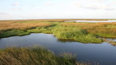
The environmental and infrastructural conditions that brought about the flooding of New Orleans during Hurricane Katrina in 2005 remain today, and have the potential to cause similar devastation, according to this piece.
"[A]s geographer Richard Campanella makes plain in his new book, Delta Urbanism: New Orleans, the immediate catastrophe - the one that could not be ignored, that attracted international attention and inspired relief efforts and planning proposals and federal promises - has given way to the slow-building potential for future catastrophe - one that seems all too easy to ignore. For the underlying conditions that caused the devastation remain much the same. Not only are the flood-protection systems that have been constructed to protect the low-lying city pathetically inadequate - "under-engineered, cavalierly inspected and poorly maintained," in Campanella's words; still more, a century of intensive environmental manipulation has neutralized or destroyed the natural systems - the coastal wetlands, barrier islands, etc. - that would buffer the effects of seasonal storms and cyclical flooding."
Campanella documents the days leading up to the flooding and how human interference with the area's delta environment enabled the destruction.
FULL STORY: Delta Urbanism and New Orleans: Before

New Orleans Convent to Become Large Urban Wetland
Hurricane Katrina damaged a Catholic convent in New Orleans. Then the nuns spearheaded a project to transform the land into a wetland area that will protect the city from flooding in the future.
Hurricane Nate to Test New Orlean's Drainage System
Nate will make landfall southeast of New Orleans on Saturday night as possibly a category 2 hurricane after leaving at least 22 dead in Central America. It's not so much the levees but the pumps and generators that have city officials worried.
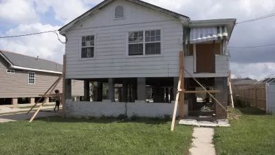
Louisiana Dials Back Requirements for Elevating Homes in Flood Areas
Housing market pressures, flood insurance costs, changing FEMA maps, and improved methods of flood control are giving victims of flood damage in Louisiana mixed signals on how high they should rebuild their homes.

Maui's Vacation Rental Debate Turns Ugly
Verbal attacks, misinformation campaigns and fistfights plague a high-stakes debate to convert thousands of vacation rentals into long-term housing.

Planetizen Federal Action Tracker
A weekly monitor of how Trump’s orders and actions are impacting planners and planning in America.

In Urban Planning, AI Prompting Could be the New Design Thinking
Creativity has long been key to great urban design. What if we see AI as our new creative partner?

King County Supportive Housing Program Offers Hope for Unhoused Residents
The county is taking a ‘Housing First’ approach that prioritizes getting people into housing, then offering wraparound supportive services.

Researchers Use AI to Get Clearer Picture of US Housing
Analysts are using artificial intelligence to supercharge their research by allowing them to comb through data faster. Though these AI tools can be error prone, they save time and housing researchers are optimistic about the future.

Making Shared Micromobility More Inclusive
Cities and shared mobility system operators can do more to include people with disabilities in planning and operations, per a new report.
Urban Design for Planners 1: Software Tools
This six-course series explores essential urban design concepts using open source software and equips planners with the tools they need to participate fully in the urban design process.
Planning for Universal Design
Learn the tools for implementing Universal Design in planning regulations.
planning NEXT
Appalachian Highlands Housing Partners
Mpact (founded as Rail~Volution)
City of Camden Redevelopment Agency
City of Astoria
City of Portland
City of Laramie