


High speed rail is slowly transitioning from idea to reality in California, and one of its major stops will be in Los Angeles. But exactly where in Los Angeles remains an unanswered question.
The new rail system will require an updated train station in L.A. The City Council recently urged the state high speed rail authority to consider two options.
"Councilman Ed Reyes said the alternatives were crucial to protecting residents in East L.A. as planners determine the route for the 800-mile bullet train between Northern California and San Diego. Proponents say the train would carry passengers from L.A. to San Francisco in about 2 1/2 hours.
The two alternatives are an aerial stop at Union Station where the bullet train would be stacked above Metrolink tracks, or a stop on the east side of Patsaouras Transit Plaza, along Vignes Street.
A city planner said the second option could minimize intrusions into communities north and south."
FULL STORY: Bullet train officials urged to weigh 2 options at Union Station

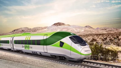
L.A.-Las Vegas High Speed Rail Could Break Ground Next Year
The privately funded train would shuttle passengers between Los Angeles and Las Vegas in half the time it takes to drive and could take 3 million vehicles off the road.

Astonishing Images of L.A.'s Lost Train Stations
Nathan Masters collects astonishing images and histories of L.A.'s vanished train depots, some of which rival the city's greatest architectural treasures. As L.A. rebuilds its lost transit infrastructure, these images are especially heartbreaking.
Developing A Coexistence Between High Speed Rail and L.A.
Los Angeles architect Roger Sherman is trying to help guide the car-centric L.A. area into harmonious coexistence with the state's planned high speed rail.

Planetizen Federal Action Tracker
A weekly monitor of how Trump’s orders and actions are impacting planners and planning in America.

Maui's Vacation Rental Debate Turns Ugly
Verbal attacks, misinformation campaigns and fistfights plague a high-stakes debate to convert thousands of vacation rentals into long-term housing.

San Francisco Suspends Traffic Calming Amidst Record Deaths
Citing “a challenging fiscal landscape,” the city will cease the program on the heels of 42 traffic deaths, including 24 pedestrians.

Defunct Pittsburgh Power Plant to Become Residential Tower
A decommissioned steam heat plant will be redeveloped into almost 100 affordable housing units.

Trump Prompts Restructuring of Transportation Research Board in “Unprecedented Overreach”
The TRB has eliminated more than half of its committees including those focused on climate, equity, and cities.

Amtrak Rolls Out New Orleans to Alabama “Mardi Gras” Train
The new service will operate morning and evening departures between Mobile and New Orleans.
Urban Design for Planners 1: Software Tools
This six-course series explores essential urban design concepts using open source software and equips planners with the tools they need to participate fully in the urban design process.
Planning for Universal Design
Learn the tools for implementing Universal Design in planning regulations.
Heyer Gruel & Associates PA
JM Goldson LLC
Custer County Colorado
City of Camden Redevelopment Agency
City of Astoria
Transportation Research & Education Center (TREC) at Portland State University
Jefferson Parish Government
Camden Redevelopment Agency
City of Claremont