


Tysons Corner is hoping to go from a 9-to-5 work farm to a 24-hour city.
Planners in this suburban D.C. community want to double or even triple the city's density, bringing its population of 17,000 closer to the 120,000 that work there.
The inspiration for this proposed sea change is the 23-mile rail extension that has been approved between D.C.'s Dulles International Airport and the center city. Four stops will be included in Tysons Corner.
"The blueprint, which has been four years in the making and calls for a dense, walkable green city, is a model of public-private partnership and the largest such undertaking in the country. The implications of this redevelopment project stretch far beyond Fairfax County, as suburbs and exurbs across the country look for ways to repair the damage from five decades of outward, rather than upward, expansion. There are scores of so-called edge cities that have popped up near urban centers, suburbs on steroids that often grew around a giant mall - like King of Prussia, Pa. (outside Philadelphia), and Schaumburg, Ill. (Chicago). 'If Tysons can be retrofitted, then there's great hope for a lot of others,' says June Williamson, an associate professor of architecture at the City College of New York and a co-author of Retrofitting Suburbia."
FULL STORY: A (Radical) Way to Fix Suburban Sprawl

Feds To Allow Rail Between D.C. and Airport
Federal officials have reversed their earlier decision and are now pushing for the extension of Washington D.C.-area metro rail to Dulles International Airport -- a plan that's been in the works for nearly 40 years.
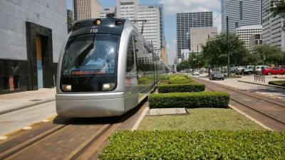
Two Studies Show How Light Rail Benefits Houston
Finally, the city seems to be reaping benefits from a major investment in public transportation.
Dulles Metro Link to Run Nearly $4 Billion
The second phase of a project to connect Washington D.C.'s Metro system to Dulles International Airport will cost nearly $4 billion.

Maui's Vacation Rental Debate Turns Ugly
Verbal attacks, misinformation campaigns and fistfights plague a high-stakes debate to convert thousands of vacation rentals into long-term housing.

Planetizen Federal Action Tracker
A weekly monitor of how Trump’s orders and actions are impacting planners and planning in America.

Chicago’s Ghost Rails
Just beneath the surface of the modern city lie the remnants of its expansive early 20th-century streetcar system.

Bend, Oregon Zoning Reforms Prioritize Small-Scale Housing
The city altered its zoning code to allow multi-family housing and eliminated parking mandates citywide.

Amtrak Cutting Jobs, Funding to High-Speed Rail
The agency plans to cut 10 percent of its workforce and has confirmed it will not fund new high-speed rail projects.

LA Denies Basic Services to Unhoused Residents
The city has repeatedly failed to respond to requests for trash pickup at encampment sites, and eliminated a program that provided mobile showers and toilets.
Urban Design for Planners 1: Software Tools
This six-course series explores essential urban design concepts using open source software and equips planners with the tools they need to participate fully in the urban design process.
Planning for Universal Design
Learn the tools for implementing Universal Design in planning regulations.
planning NEXT
Appalachian Highlands Housing Partners
Mpact (founded as Rail~Volution)
City of Camden Redevelopment Agency
City of Astoria
City of Portland
City of Laramie