


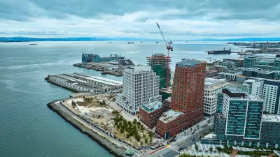
San Francisco building codes encouraged the creation of privately-owned, publicly-accessible spaces across the downtown. These spaces have gone underused and are little understood. A new report from SPUR attempts to clear the fog.
"The shortage of public spaces in San Francisco's downtown has long been compounded by the fact that the urban geography of privately owned public open spaces (POPOS) makes them hard to find and even harder to enjoy. San Francisco Planning and Urban Research (SPUR) last week released a report that details all of downtown's POPOS, complete with a printable map (PDF), and makes recommendations on how to improve access and amenities.
San Francisco's first privately owned, publicly accessible park was constructed at the base of the Transamerica building in the late 1960s. At that time, building codes neither required nor encouraged development of public space at street level, and accordingly most office towers were built right to the edge of the property. The few exceptions were in buildings where developers sought density and height bonuses and created public space as a condition for approval.
In the 1985 Downtown Plan the city codified the conditions under which developers had to construct publicly accessible open spaces, which could be as diverse as plazas, greenhouses, or atriums, but had to comply with standards of landscaping, design, seating, and bathrooms. Yet, the city made no effort to provide information about the plazas in aggregate."
FULL STORY: Unlocking San Francisco’s Privately Owned Public Open Spaces


The Simple Legislative Tool Transforming Vacant Downtowns
In California, Michigan and Georgia, an easy win is bringing dollars — and delight — back to city centers.

San Francisco Opens Park on Former Great Highway
The Sunset Dunes park’s grand opening attracted both fans and detractors.
San Francisco Development Centers Pedestrians, Public Space
The Mission Rock project eliminates street parking, replacing it with public seating and landscaping.

Planetizen Federal Action Tracker
A weekly monitor of how Trump’s orders and actions are impacting planners and planning in America.

Maui's Vacation Rental Debate Turns Ugly
Verbal attacks, misinformation campaigns and fistfights plague a high-stakes debate to convert thousands of vacation rentals into long-term housing.

Restaurant Patios Were a Pandemic Win — Why Were They so Hard to Keep?
Social distancing requirements and changes in travel patterns prompted cities to pilot new uses for street and sidewalk space. Then it got complicated.

In California Battle of Housing vs. Environment, Housing Just Won
A new state law significantly limits the power of CEQA, an environmental review law that served as a powerful tool for blocking new development.

Boulder Eliminates Parking Minimums Citywide
Officials estimate the cost of building a single underground parking space at up to $100,000.

Orange County, Florida Adopts Largest US “Sprawl Repair” Code
The ‘Orange Code’ seeks to rectify decades of sprawl-inducing, car-oriented development.
Urban Design for Planners 1: Software Tools
This six-course series explores essential urban design concepts using open source software and equips planners with the tools they need to participate fully in the urban design process.
Planning for Universal Design
Learn the tools for implementing Universal Design in planning regulations.
Heyer Gruel & Associates PA
JM Goldson LLC
Custer County Colorado
City of Camden Redevelopment Agency
City of Astoria
Transportation Research & Education Center (TREC) at Portland State University
Jefferson Parish Government
Camden Redevelopment Agency
City of Claremont