


DeSoto and Ferguson are the first two cities in Missouri to adopt Complete Street plans. The ordinances are in place to encourage walking and biking, and, ultimately, healthier lifestyles.
"'Complete Streets legislation has been popping up across the country at various levels of government and is often cited as the beginning of a more comprehensive commitment to building healthier communities,' said Phil Valko, Trailnet Active Living Program Manager. 'Complete Streets means more walkers and bikers, therefore healthier individuals; more walkers and bikers means more neighbor-to-neighbor interaction, resulting in stronger communities; and less driving means less pollution, resulting in a healthier environment.'"
"As mentioned in the minutes of the Ferguson City Council Meeting in which this ordinance was adopted, the city staff does currently take many of these principles in mind when planning public works projects; however, they were not captured in the municipal code. This ordinance will provide a specific reference to Complete Streets in the policy of the city and provide for a method to ensure that this is investigated in every instance. It is also important to note that such an ordinance is now being requested as an element of many construction-related grants that the city may be eligible for, including the Safe Routes to School Program, and will be very beneficial for the city in pursuing funding mechanisms."
FULL STORY: Two Missouri Cities Adopt Complete Streets Policy

The Shifting Demographics of Covid-19
For most of the Covid-19 pandemic, Black Americans died at much higher rates than White Americans. That trend has reversed at times during the past year.

Obesity Tied to Suburban Life
London-based study ties obesity to sprawl and finds that suburbs have a bigger obesity problem than rural areas.
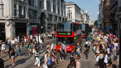
Study Touts the Public Health Benefits of Dense, Urban Living
A study of British cities find people living in dense urban cores are less likely to struggle with obesity and more likely to exercise—signs of higher quality of life—than their counterparts in suburban environments.

Maui's Vacation Rental Debate Turns Ugly
Verbal attacks, misinformation campaigns and fistfights plague a high-stakes debate to convert thousands of vacation rentals into long-term housing.

Planetizen Federal Action Tracker
A weekly monitor of how Trump’s orders and actions are impacting planners and planning in America.

In Urban Planning, AI Prompting Could be the New Design Thinking
Creativity has long been key to great urban design. What if we see AI as our new creative partner?

King County Supportive Housing Program Offers Hope for Unhoused Residents
The county is taking a ‘Housing First’ approach that prioritizes getting people into housing, then offering wraparound supportive services.

Researchers Use AI to Get Clearer Picture of US Housing
Analysts are using artificial intelligence to supercharge their research by allowing them to comb through data faster. Though these AI tools can be error prone, they save time and housing researchers are optimistic about the future.

Making Shared Micromobility More Inclusive
Cities and shared mobility system operators can do more to include people with disabilities in planning and operations, per a new report.
Urban Design for Planners 1: Software Tools
This six-course series explores essential urban design concepts using open source software and equips planners with the tools they need to participate fully in the urban design process.
Planning for Universal Design
Learn the tools for implementing Universal Design in planning regulations.
planning NEXT
Appalachian Highlands Housing Partners
Mpact (founded as Rail~Volution)
City of Camden Redevelopment Agency
City of Astoria
City of Portland
City of Laramie