


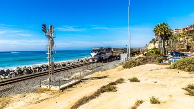
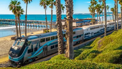
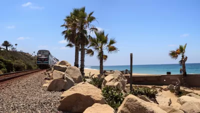
Train tracks running along the Pacific Ocean are in danger from sea level rise, but residents are divided on how to fix the problem.
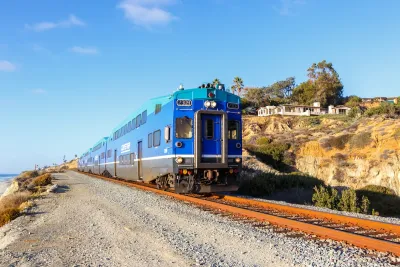
A rail line in Southern California is growing increasingly unstable due to coastal erosion, but local residents and officials are in disagreement over how and where to relocate it.
Last week, the San Diego Association of Governments voted to narrow down the proposed plans to four options, “But a final decision remains far off.”
After SANDAG presented three potential options for relocating the track, “Del Mar residents raised concerns about tunnel construction and operations beneath their homes, citing risks from vibration and pollution.” One route was opposed by environmentalists because it cut through a lagoon. Another, which would have tunneled under the San Diego County Fairgrounds, also faced opposition.
“In light of all that, the agency re-examined the issue, ultimately leading to the vote on Friday. Three of the options now on the table would move the line off the bluffs; a fourth would keep the track where it is, reinforce the bluffs and add a second track next to the existing one.” Meanwhile, emergency repairs offer only a short-term solution for the problem as local officials continue to debate their options.
FULL STORY: A Scenic California Rail Line Sits on an Eroding Cliff. Where Should the Tracks Go?

Storms Sever California Rail Line—Again
The coast-hugging rail corridor linking Los Angeles and San Diego faces an uncertain future as mudslides once again force part of the line to close.
Southern California Rail Corridor In Danger From Erosion, Lack of Leadership
With a patchwork of management and local agencies involved, the imperiled rail corridor has no unified plan for improving or relocating tracks impacted by coastal erosion.
State Leaders Warn of Risks to Southern California Rail Corridor
Coastal erosion and rising sea levels threaten one of the nation’s most scenic—and strategically important—rail corridors.

Montreal Mall to Become 6,000 Housing Units
Place Versailles will be transformed into a mixed-use complex over the next 25 years.

Planetizen Federal Action Tracker
A weekly monitor of how Trump’s orders and actions are impacting planners and planning in America.

DARTSpace Platform Streamlines Dallas TOD Application Process
The Dallas transit agency hopes a shorter permitting timeline will boost transit-oriented development around rail stations.

Study: 4% of Truckers Lack a Valid Commercial License
Over 56% of inspected trucks had other violations.

Chicago Judge Orders Thousands of Accessible Ped Signals
Only 3% of the city's crossing signals are currently accessible to blind pedestrians.

Philadelphia Swaps Car Lanes for Bikeways in Unanimous Vote
The project will transform one of the handful of streets responsible for 80% of the city’s major crashes.
Urban Design for Planners 1: Software Tools
This six-course series explores essential urban design concepts using open source software and equips planners with the tools they need to participate fully in the urban design process.
Planning for Universal Design
Learn the tools for implementing Universal Design in planning regulations.
City of Mt Shasta
City of Camden Redevelopment Agency
City of Astoria
Transportation Research & Education Center (TREC) at Portland State University
US High Speed Rail Association
City of Camden Redevelopment Agency
Municipality of Princeton (NJ)