


The app gives step-by-step directions and audio and visual cues accessible from anywhere for thousands of bus stops and rail stations.
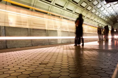
Passengers with visual impairments on the D.C.-area transit system can now use an app to navigate the network, making the Washington Metropolitan Area Transit Authority’s system one of the nation’s most accessible, according to a press release from app developer Waymap.
As Kea Wilson explains in an article in Streetsblog USA, the app relies on the phone’s motion sensors to let users navigate even underground, making it potentially “the first and only indoor mapping service that requires no external infrastructure to work.” It also provides turn-by-turn audio cues and touts “step-level accuracy.”
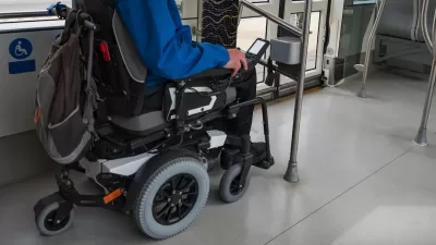
Wilson’s article points out that the app has had unexpected benefits for users beyond people with visual impairments. “Users can request routes that avoid stairs, escalators, and elevators, for instance, or ask the app to send them alerts about the exact location of wheelchair ramps before they leave the house and find themselves stranded without one. They can fine tune the speed and pitch of audio alerts to match their preferences and cognitive needs, as well as switch between four different languages.”
The company hopes the app can offer a more inclusive transit experience and plans to expand to more cities, as well as map the interior of other locations such as grocery stores and hospitals to offer a more complete end-to-end travel experience. While Washington, D.C. is the first system to be fully available on the platform, the app is also live in some locations in other cities including Los Angeles, Brisbane, Australia, and Madrid, Spain.
FULL STORY: This App Could Make D.C. One of the Most Accessible Transit Networks In the World

USDOT Issues Accessibility Guidelines for Transit Stations
A new rule aims to clarify accessibility requirements to help state and local DOTs upgrade their facilities more quickly to meet ADA standards.
Report: NYC Transit Accessibility Depends on Congestion Pricing Revenue
The ability of the MTA to complete its accessibility upgrades relies on funding from the upcoming congestion pricing program.

Braille Signage Now at All Vancouver Bus Stops
The city completed installation of signage for people with visual impairments at over 8,000 bus stops.

Montreal Mall to Become 6,000 Housing Units
Place Versailles will be transformed into a mixed-use complex over the next 25 years.

Planetizen Federal Action Tracker
A weekly monitor of how Trump’s orders and actions are impacting planners and planning in America.

DARTSpace Platform Streamlines Dallas TOD Application Process
The Dallas transit agency hopes a shorter permitting timeline will boost transit-oriented development around rail stations.

Study: 4% of Truckers Lack a Valid Commercial License
Over 56% of inspected trucks had other violations.

Chicago Judge Orders Thousands of Accessible Ped Signals
Only 3% of the city's crossing signals are currently accessible to blind pedestrians.

Philadelphia Swaps Car Lanes for Bikeways in Unanimous Vote
The project will transform one of the handful of streets responsible for 80% of the city’s major crashes.
Urban Design for Planners 1: Software Tools
This six-course series explores essential urban design concepts using open source software and equips planners with the tools they need to participate fully in the urban design process.
Planning for Universal Design
Learn the tools for implementing Universal Design in planning regulations.
City of Mt Shasta
City of Camden Redevelopment Agency
City of Astoria
Transportation Research & Education Center (TREC) at Portland State University
US High Speed Rail Association
City of Camden Redevelopment Agency
Municipality of Princeton (NJ)