


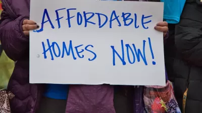
Spiking insurance costs in coastal areas prone to climate disasters are making it harder for low-income housing developers to keep building.
Extreme weather driven by climate change is making it increasingly difficult to build affordable housing, reports Kelly Kenoyer in a piece for WHQR. This is largely because insurance companies are hiking premiums or refusing to cover regions prone to natural disasters.
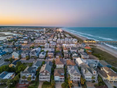
According to one North Carolina affordable housing developer, premiums have gone up by as much as 70 percent. “Coastal North Carolina is a major retirement hub: The two fastest growing counties in the state, Pender and Brunswick, are next door to New Hanover County, and much of that growth is from retirees. Many of those moving have higher incomes than local residents, which helps drive up market-rate rents: and pushes some locals out of their homes, unless they can find subsidized apartments.”
As Kenoyer explains, “That chilling effect hits tax credit developers more than for-profit developers. After all: market rate developers can just increase rents to cover the rising tides of insurance.” Meanwhile, retirees from around the United States continue to move to disaster-prone areas, keeping demand for housing in coastal areas high.
The article notes that the federal government could ease the burden on affordable housing developers by standardizing requirements for the various housing programs used by low-income housing builders and incentivizing building climate-resilient properties.
FULL STORY: Climate-driven insurance hikes are making affordable housing even harder to build

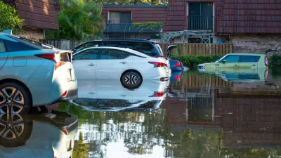
Auto Insurance Rates Spike Due to Extreme Weather
Car insurance costs around the country are going up as insurers receive more claims from areas struck by storms and other climate disasters.
America’s Housing Crisis: Lessons Ignored and Challenges Ahead
A recent study reveals how decades of policy missteps, demographic shifts, and economic forces fueled America’s housing crisis, leaving millions — especially millennials — struggling amid rising demand, racial disparities, and climate-driven emergencies.
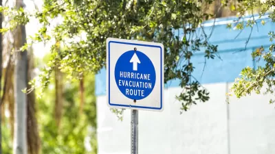
Will Hurricanes Drive Away Florida’s Retirees?
Some children of Florida retirees are urging their parents to leave hurricane-prone areas for safer regions.

Planetizen Federal Action Tracker
A weekly monitor of how Trump’s orders and actions are impacting planners and planning in America.

DARTSpace Platform Streamlines Dallas TOD Application Process
The Dallas transit agency hopes a shorter permitting timeline will boost transit-oriented development around rail stations.

Four Reasons Urban Planners Can’t Ignore AI
It’s no longer a question of whether AI will shape planning, but how. That how is up to us.

Bikeshare for the Win: Team Pedals to London Cricket Match, Beats Rivals Stuck in Traffic
While their opponents sat in gridlock, England's national cricket team hopped Lime bikes, riding to a 3-0 victory.

Amtrak’s Borealis Exceeds First Year Ridership Expectations
205,800 passengers have boarded the St. Paul to Chicago line, well above initial MDOT projections.

Study: 4% of Truckers Lack a Valid Commercial License
Over 56% of inspected trucks had other violations.
Urban Design for Planners 1: Software Tools
This six-course series explores essential urban design concepts using open source software and equips planners with the tools they need to participate fully in the urban design process.
Planning for Universal Design
Learn the tools for implementing Universal Design in planning regulations.
City of Mt Shasta
City of Camden Redevelopment Agency
City of Astoria
Transportation Research & Education Center (TREC) at Portland State University
US High Speed Rail Association
City of Camden Redevelopment Agency
Municipality of Princeton (NJ)