


A few key changes can help downtowns out of the ‘urban doom loop.’
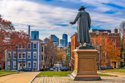
How do we preserve crucial walkable urban places? Robert Steuteville seeks to answer this question in a piece for CNU Public Square, referencing a new report called Reiminaging Cities: Disrupting the Urban Doom Loop from Cushman & Wakefield with Christopher Leinberger and Places Platform.
The report outlines the importance of Walkable urban places (WalkUPs) as “efficient economic engines” that generate 57 percent of GDP while only taking up 3 percent of land in 15 major metro areas studied by the authors.
For decades, these urban centers focused on office buildings as the driving force. “Using portfolio theory to rebalance real estate toward less office space (work), more play (culture, entertainment, retail), and more residential (especially for-sale housing) would shift these urban centers back to the positive economic track they were on prior to COVID, the report concludes.”
Key recommendations include reducing the amount of office space and increasing residential units via conversion and new construction, increasing the diversity of businesses and services, and adding more amenities geared toward entertainment and recreation.
The report calls our current ‘doom loop’ an ‘episodic’ one that can be rectified through zoning and regulatory reform and a shift to accommodating more diverse uses and schedules.
FULL STORY: How to reverse the ‘urban doom loop’


How the Post-Covid Reality Is Reshaping Central Business Districts and Urban Centers
U.S. cities are working to redefine their downtowns in response to the “donut effect:” people and businesses abandoning city centers and flocking to suburban areas and beyond.
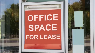
Office Vacancies Drag Down Property Taxes
Downtown office buildings around the country are selling for much lower prices than before the pandemic, prompting questions about the future of central business districts.
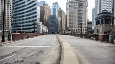
Major US Cities Still Suffering Downtown Decline
Research shows that the “donut effect” hollowing out central business districts since the pandemic continues to cause economic decline in the 12 largest American cities.

Planetizen Federal Action Tracker
A weekly monitor of how Trump’s orders and actions are impacting planners and planning in America.

San Francisco's School District Spent $105M To Build Affordable Housing for Teachers — And That's Just the Beginning
SFUSD joins a growing list of school districts using their land holdings to address housing affordability challenges faced by their own employees.

Can We Please Give Communities the Design They Deserve?
Often an afterthought, graphic design impacts everything from how we navigate a city to how we feel about it. One designer argues: the people deserve better.

The EV “Charging Divide” Plaguing Rural America
With “the deck stacked” against rural areas, will the great electric American road trip ever be a reality?

Judge Halts Brooklyn Bike Lane Removal
Lawyers must prove the city was not acting “arbitrarily, capriciously, and illegally” in ordering the hasty removal.

Engineers Gave America's Roads an Almost Failing Grade — Why Aren't We Fixing Them?
With over a trillion dollars spent on roads that are still falling apart, advocates propose a new “fix it first” framework.
Urban Design for Planners 1: Software Tools
This six-course series explores essential urban design concepts using open source software and equips planners with the tools they need to participate fully in the urban design process.
Planning for Universal Design
Learn the tools for implementing Universal Design in planning regulations.
Borough of Carlisle
Smith Gee Studio
City of Camden Redevelopment Agency
City of Astoria
Transportation Research & Education Center (TREC) at Portland State University
City of Camden Redevelopment Agency
Municipality of Princeton (NJ)