


An explainer of the monetary, environmental, and social costs of exuberant road building.
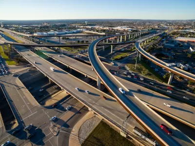
Reporting for KERA, Nathan Bernier outlines how the Texas Department of Transportation (TxDOT), which spends more on highways than any other state, funds its road projects. In the last ten years alone, Texas added 700 miles of new highways.
As Bernier explains, “The money for highways comes from a mix of gas taxes, vehicle registration fees, state sales taxes, levies on oil and gas companies and federal funds — which includes a big chunk of money from personal income taxes.” Historically, highways have been funded via a consumer gas tax that goes into the federal Highway Trust Fund. Now, federal dollars make up a smaller percentage of state’s road funding, and the Highway Trust Fund routinely runs out of money. “The federal gas tax — now 18.4 cents a gallon — hasn’t risen since President Bill Clinton's first year in office. The Texas gas tax is even older, frozen at 20 cents a gallon since 1991.”
Texas voters supported additional highway funding through several measures, letting the state dip into its Rainy Day Fund and allocating part of the state sales tax to road projects.
However, it’s not just about construction costs. “The true cost also includes external factors like traffic congestion, displacement, environmental impacts, and land use changes, all of which affect local communities.” Additionally, highways encourage sprawling suburbs and inefficient land use and prioritize driving over transit and other forms of transportation.
FULL STORY: Who pays for Texas highways?

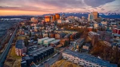
Anchorage High-Speed Highway Project Met With Skepticism
The Alaska Department of Transportation and its consultants are working on a Planning and Environmental Linkages study of the Glenn-Seward Highway that bisects the middle of Anchorage, Alaska.

Proposal Would Link Highway Funding to Zoning
Experts argue that zoning, housing, and transportation policy are intimately linked.
‘Divided by Design’ Underscores Inequities in Transportation Policy
The report calls for a wholesale overhaul of U.S. transportation policy to redress the damages caused by decades of auto-centric development.

Rethinking Redlining
For decades we have blamed 100-year-old maps for the patterns of spatial racial inequity that persist in American cities today. An esteemed researcher says: we’ve got it all wrong.

Planetizen Federal Action Tracker
A weekly monitor of how Trump’s orders and actions are impacting planners and planning in America.
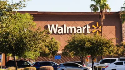
Walmart Announces Nationwide EV Charging Network
The company plans to install electric car chargers at most of its stores by 2030.

Seattle’s Pike Place Market Leans Into Pedestrian Infrastructure
After decades of debate, the market is testing a car ban in one of its busiest areas and adding walking links to the surrounding neighborhood.

The World’s Longest Light Rail Line is in… Los Angeles?
In a city not known for its public transit, the 48.5-mile A Line is the longest of its kind on the planet.

Quantifying Social Infrastructure
New developments have clear rules for ensuring surrounding roads, water, and sewers can handle new users. Why not do the same for community amenities?
Urban Design for Planners 1: Software Tools
This six-course series explores essential urban design concepts using open source software and equips planners with the tools they need to participate fully in the urban design process.
Planning for Universal Design
Learn the tools for implementing Universal Design in planning regulations.
City of Moorpark
City of Tustin
City of Camden Redevelopment Agency
City of Astoria
Transportation Research & Education Center (TREC) at Portland State University
Regional Transportation Commission of Southern Nevada
Toledo-Lucas County Plan Commissions