


The project aims to bring zoning data from around the country into one database, making it easier for planners and researchers to compare policies and their impacts.
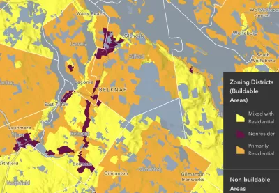
An article in PD&R Edge highlights progress on the National Zoning Atlas, an effort to consolidate nationwide zoning data into one GIS database to let researchers analyze and compare zoning policies and their effects. “The purpose of the atlas is to offer insight into zoning’s effects and democratize land use decisionmaking through comprehensive, digitized, and user-friendly zoning information.”
The creators of the Zoning Atlas say “the decentralization of zoning laws has hindered the identification of problems arising from land use regulations.” The effort is already underway in 21 states, and almost complete in New Hampshire.
“An ongoing challenge that the atlas can help address is the obfuscating effects of complex and competing land use interests to reform.” As the article explains, “Aggregating this information makes the scale of statewide challenges more readily apparent and could bring stakeholders on board to address the collective action problems that intricate zoning systems pose.”
FULL STORY: Creating the National Zoning Atlas


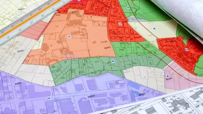
National Zoning Atlas Expands
The online tool can help city and state officials understand where zoning codes need reform and how they compare to other localities.
How a National Zoning Atlas Can Clarify a Legal Patchwork
A massive effort is underway to compile local zoning regulations and other laws that impact how and where housing is built.

Dallas Code Reform Makes Way for Missing Middle Housing
The Dallas City Council voted to change the city’s building code to allow up to eight residential units in three-story buildings.

Rethinking Redlining
For decades we have blamed 100-year-old maps for the patterns of spatial racial inequity that persist in American cities today. An esteemed researcher says: we’ve got it all wrong.

Montreal Mall to Become 6,000 Housing Units
Place Versailles will be transformed into a mixed-use complex over the next 25 years.

Planetizen Federal Action Tracker
A weekly monitor of how Trump’s orders and actions are impacting planners and planning in America.

LA ‘Mobility Wallet’ Increased Quality of Life for Participants
The city distributed a monthly $150 transportation subsidy to 1,000 low-income Angelenos. It dramatically improved their lives.

Texas, California Rail Projects Seek Out Private Funding
In the wake of Trump’s cuts to high-speed rail projects, rail authorities are looking to private-public partnerships to supplement their budgets.

Addressing Rural Homelessness in Kentucky
A Kentucky Lantern series focuses on the challenges unhoused Kentuckians face and efforts to provide support and assistance.
Urban Design for Planners 1: Software Tools
This six-course series explores essential urban design concepts using open source software and equips planners with the tools they need to participate fully in the urban design process.
Planning for Universal Design
Learn the tools for implementing Universal Design in planning regulations.
City of Camden Redevelopment Agency
City of Astoria
Transportation Research & Education Center (TREC) at Portland State University
Regional Transportation Commission of Southern Nevada
Toledo-Lucas County Plan Commissions