


Two footbridges now link the High Line park to the most recent expansion of the Penn Station complex, the Moynihan Train Hall.
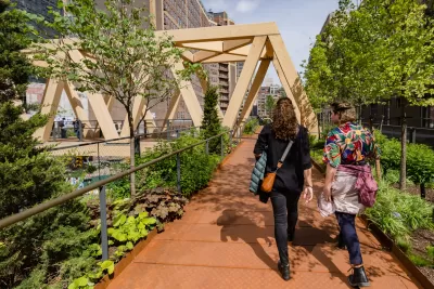
A new pedestrian pathway connects New York City’s High Line to the recently opened Moynihan Train Hall, reports Pansy Schulman in Architectural Record. “Now, one can walk from the High Line’s southern terminus over a mile away in the West Village to the intersection of 9th Avenue and 34th Street (a notoriously inhospitable pedestrian environment) without stepping foot on public pavement.”
“Comprising a pair of footbridges—one lushly planted and the other featuring a dramatic mass-timber truss structure—that float above a tangle of busy roadways, the combined 600-foot-long pedestrian pathway fuses together various components of Manhattan’s Far West Side: the High Line, Hudson Yards, the mixed-use Manhattan West development, and, to the east, the new Moynihan Train Hall.”
Designed by SOM and James Corner Field Operations, the $50 million connector project is a public-private partnership owned by Empire State Development and maintained by the nonprofit Friends of the High Line.
FULL STORY: Manhattan Gains an Elevated Pedestrian Path Linking the High Line with Moynihan Train Hall

Proposal Would Connect the High Line to the New Moynihan Train Hall
The High Line has a chance to add the role of civic connector to its list of plaudits.
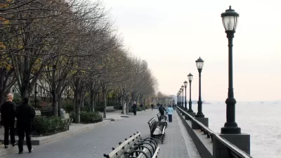
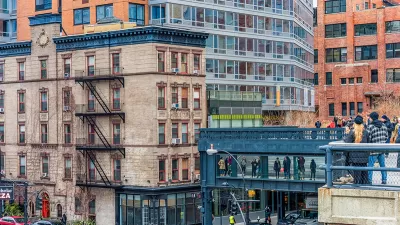
Meet Some of New York City's Newest Parks
In a city where density is everything, these park projects make creative use of existing public spaces—and, in some cases, create their own.
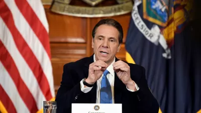
Massive, Expensive Redevelopment of Midtown Manhattan Proposed
New York Governor Cuomo's State of the State speeches last week included an ambitious proposal for a large-scale redevelopment project on Manhattan's west side, adjacent to Penn Station.

Montreal Mall to Become 6,000 Housing Units
Place Versailles will be transformed into a mixed-use complex over the next 25 years.

Planetizen Federal Action Tracker
A weekly monitor of how Trump’s orders and actions are impacting planners and planning in America.

DARTSpace Platform Streamlines Dallas TOD Application Process
The Dallas transit agency hopes a shorter permitting timeline will boost transit-oriented development around rail stations.

Without International Immigrants, the Rural US Population Would Be Falling 58%
Census data shows that population growth in rural areas is due in large part to international migrants.

Dead End: Nine Highways Ready for Retirement
The Freeways Without Futures report describes the nation’s most promising highway removal proposals.

Congressman Proposes Bill to Rename DC Metro “Trump Train”
The Make Autorail Great Again Act would withhold federal funding to the system until the Washington Metropolitan Area Transit Authority (WMATA), rebrands as the Washington Metropolitan Authority for Greater Access (WMAGA).
Urban Design for Planners 1: Software Tools
This six-course series explores essential urban design concepts using open source software and equips planners with the tools they need to participate fully in the urban design process.
Planning for Universal Design
Learn the tools for implementing Universal Design in planning regulations.
City of Mt Shasta
City of Camden Redevelopment Agency
City of Astoria
Transportation Research & Education Center (TREC) at Portland State University
City of Camden Redevelopment Agency
Municipality of Princeton (NJ)
Regional Transportation Commission of Southern Nevada