


Location intelligence is transforming decision-making, with an increasing number and type of organizations modernizing operations with a geographic approach to problem-solving, planning, and prediction.
Location intelligence is the process of deriving meaningful insights from geospatial data to solve specific problems. This involves layering multiple data sets spatially and/or chronologically, for easy reference on a map, and its applications span industries, categories, and organizations. Location intelligence is facilitated by the use of geographical information system (GIS) tools which enable analysts to effectively and efficiently collect, stores, analyze, and visualize data.
Location intelligence experts can use a variety of spatial and business analytical tools to measure optimal locations for operating a business or providing a service. They begin with defining the business ecosystem which is influenced by many interconnected factors, including (but are not limited to): culture, lifestyle, labor, healthcare, cost of living, crime, economic climate, and education.
In this post, Esri, the well-known GIS software company, explains how leaders in business and government are applying location technology to meet a wide variety of needs. Examples of location intelligence use cases include finding optimal locations in retail site selection, managing assets in real time, supply chain optimization, and building or maintaining vital infrastructure. Esri points out that location is key to solving many of today's challenges as geography pulls together all key information about important issues such as infrastructure modernization, sustainability, climate change, environmental management, and social equity.
FULL STORY: Location Intelligence: Insights that transform decision-making


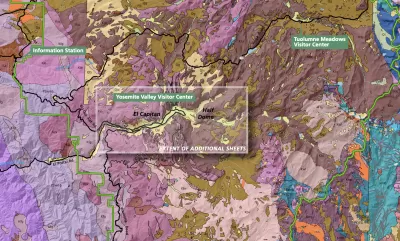
Trump Cuts Decimate Mapping Agency
The National Geodetic Survey maintains and updates critical spatial reference systems used extensively in both the public and private sectors.
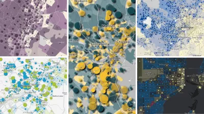
Explore US Demographics With the New ACS Atlas Collection
Esri's new ACS Atlas Collection offers interactive applications that visualize the latest U.S. demographic and socio-economic data, enabling users to explore over 175 curated web maps across various thematic areas.

New Book Shows How Geographic Technology Tackles Global Challenges
In his new book, Jack Dangermond explores the transformative impact of GIS technology in solving global challenges through spatial data, highlighting its widespread application across sectors and its potential to design sustainable futures.

Maui's Vacation Rental Debate Turns Ugly
Verbal attacks, misinformation campaigns and fistfights plague a high-stakes debate to convert thousands of vacation rentals into long-term housing.

Planetizen Federal Action Tracker
A weekly monitor of how Trump’s orders and actions are impacting planners and planning in America.

In Urban Planning, AI Prompting Could be the New Design Thinking
Creativity has long been key to great urban design. What if we see AI as our new creative partner?

Massachusetts Budget Helps Close MBTA Budget Gap
The budget signed by Gov. Maura Healey includes $470 million in MBTA funding for the next fiscal year.

Milwaukee Launches Vision Zero Plan
Seven years after the city signed its Complete Streets Policy, the city is doubling down on its efforts to eliminate traffic deaths.

Portland Raises Parking Fees to Pay for Street Maintenance
The city is struggling to bridge a massive budget gap at the Bureau of Transportation, which largely depleted its reserves during the Civd-19 pandemic.
Urban Design for Planners 1: Software Tools
This six-course series explores essential urban design concepts using open source software and equips planners with the tools they need to participate fully in the urban design process.
Planning for Universal Design
Learn the tools for implementing Universal Design in planning regulations.
Gallatin County Department of Planning & Community Development
Heyer Gruel & Associates PA
JM Goldson LLC
City of Camden Redevelopment Agency
City of Astoria
Transportation Research & Education Center (TREC) at Portland State University
Jefferson Parish Government
Camden Redevelopment Agency
City of Claremont