


The restoration of degraded lands, including properties occupied by abandoned, redundant, or unwanted infrastructure, is of great importance in Los Angeles County, where numerous underserved communities are plagued with environmental burdens.
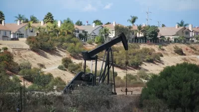
Degraded lands are often found in areas that have the most environmental burdens with respect to groundwater threat, hazardous waste, poor air quality, pollution burden, etc. These lands include properties occupied by abandoned, redundant, or unwanted infrastructure, such as decommissioned landfills, oil wells, rail yards, utility corridors, airports, and power plants. In Los Angeles County, many of the most environmentally burdened communities are also the most park poor per the Countywide Parks Needs Assessment and the most climate-vulnerable per the County Climate Vulnerability Assessment.
In locations where environmental burdens are concentrated and impactful land uses are defunct, multiple benefits can be derived from restoration projects like new parks that address residual pollution and unhealthy conditions, restore natural systems, and provide enhanced recreational opportunities for residents. In this article, park planner Clement Lau makes the case for a reimagined conservation and restoration approach that prioritizes and focuses funding and other resources to acquire, clean up, and reclaim degraded lands for park use in the communities that have the most environmental burdens.

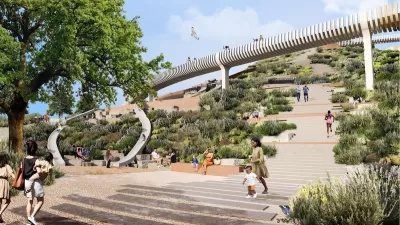
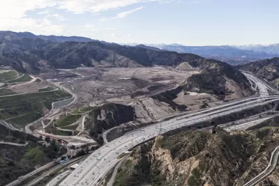
Upcycling a Landfill into a Regional Park
Los Angeles County is working with a consultant team led by Studio-MLA to transform 142 acres of the Puente Hills Landfill into parkland, creating the first new regional park in the county in over 35 years.
Advancing Equity Through Conservation and Restoration
Los Angeles County's Parks Needs Assessment Plus (PNA+) makes the case that to be equitable, 30x30 efforts must include both conservation of additional natural lands and restoration of degraded lands.
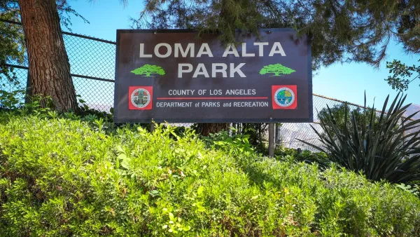
A Park Reborn: Resilience and Renewal in Fire-Stricken Altadena
Rebuilt in just two months after the devastating Eaton Fire, Loma Alta Park now stands as a symbol of community resilience and renewal, even as some residents hope recovery efforts will continue to support housing stability and long-term equity.

Planetizen Federal Action Tracker
A weekly monitor of how Trump’s orders and actions are impacting planners and planning in America.

Congressman Proposes Bill to Rename DC Metro “Trump Train”
The Make Autorail Great Again Act would withhold federal funding to the system until the Washington Metropolitan Area Transit Authority (WMATA), rebrands as the Washington Metropolitan Authority for Greater Access (WMAGA).

DARTSpace Platform Streamlines Dallas TOD Application Process
The Dallas transit agency hopes a shorter permitting timeline will boost transit-oriented development around rail stations.

Renters Now Outnumber Homeowners in Over 200 US Suburbs
High housing costs in city centers and the new-found flexibility offered by remote work are pushing more renters to suburban areas.

The Tiny, Adorable $7,000 Car Turning Japan Onto EVs
The single seat Mibot charges from a regular plug as quickly as an iPad, and is about half the price of an average EV.

Supreme Court Ruling in Pipeline Case Guts Federal Environmental Law
The decision limits the scope of a federal law that mandates extensive environmental impact reviews of energy, infrastructure, and transportation projects.
Urban Design for Planners 1: Software Tools
This six-course series explores essential urban design concepts using open source software and equips planners with the tools they need to participate fully in the urban design process.
Planning for Universal Design
Learn the tools for implementing Universal Design in planning regulations.
Municipality of Princeton
Roanoke Valley-Alleghany Regional Commission
City of Mt Shasta
City of Camden Redevelopment Agency
City of Astoria
Transportation Research & Education Center (TREC) at Portland State University
US High Speed Rail Association
City of Camden Redevelopment Agency
Municipality of Princeton (NJ)