


While residents differ on how to allocate the neighborhood’s street space, many want to see safer infrastructure for pedestrians and people on bikes.
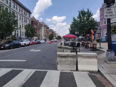
Ashley Hopko reports on efforts to bring street safety improvements to Washington, D.C.’s Adams Morgan neighborhood, where pandemic-era ‘streateries’ and bike lanes are vying with traffic lanes for space. “Adams Morgan community stakeholders are pushing for road changes that would increase safety for bicyclists and pedestrians, potentially shift bus routes, and limit vehicle access to major thoroughfares in the neighborhood.”
According to Hopko, “To address growing pains in the area, the District Department of Transportation (DDOT) began drafting the Columbia Road Bus Priority Plan in 2021. It aims to improve infrastructure for pedestrians, cyclists, and bus commuters by rethinking how street space is utilized by various modes of transit.”
In the article, two local bike commuters criticized the use of ‘sharrows,’ calling for fully segregated bike lanes that would better serve both cyclists and drivers. Advocates also want to see more pedestrian-only segments, such as on 18th Street. “The Adams Morgan Business Improvement District has been pushing for approval to repeat the pilot pedestrian zone program launched in 2020, according to Kristen Barden, the group’s executive director.”
Residents also express concerns about the on-street restaurant patios known as ‘streateries,’ Hopko writes. “Though most community members don’t seem to mind the squeeze caused by streateries, there are safety issues that arise due to narrow roadways and limited visibility caused by pop-up structures.”
FULL STORY: Adams Morgan stakeholders grapple over road safety improvements

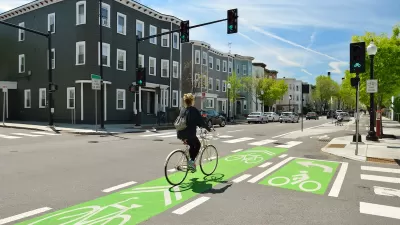
Why Bike Lanes Are Good: An Explainer for the US Transportation Secretary
Sean Duffy says there’s no evidence that bike lanes have benefits. Streetsblog — and federal agencies’ own data — beg to differ.
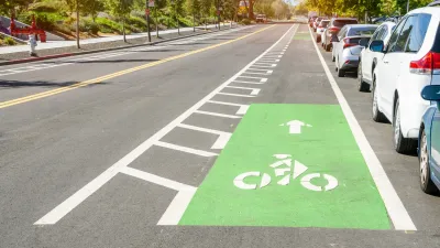
NACTO Releases Updated Urban Bikeway Guide
The third edition of the nationally recognized road design guide includes detailed design advice for roads that prioritize safety and accessibility for all users.
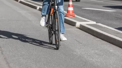
Southeast LA Road Safety Advocates Call for Improved Infrastructure
Streets in southeastern Los Angeles County have a severe lack of protected bike lanes and traffic safety measures, leading to high numbers of fatalities in a community where many residents depend on walking and biking for daily needs.

Planetizen Federal Action Tracker
A weekly monitor of how Trump’s orders and actions are impacting planners and planning in America.

Canada vs. Kamala: Whose Liberal Housing Platform Comes Out on Top?
As Canada votes for a new Prime Minister, what can America learn from the leading liberal candidate of its neighbor to the north?

The Five Most-Changed American Cities
A ranking of population change, home values, and jobs highlights the nation’s most dynamic and most stagnant regions.

San Diego Adopts First Mobility Master Plan
The plan provides a comprehensive framework for making San Diego’s transportation network more multimodal, accessible, and sustainable.

Housing, Supportive Service Providers Brace for Federal Cuts
Organizations that provide housing assistance are tightening their purse strings and making plans for maintaining operations if federal funding dries up.

Op-Ed: Why an Effective Passenger Rail Network Needs Government Involvement
An outdated rail network that privileges freight won’t be fixed by privatizing Amtrak.
Urban Design for Planners 1: Software Tools
This six-course series explores essential urban design concepts using open source software and equips planners with the tools they need to participate fully in the urban design process.
Planning for Universal Design
Learn the tools for implementing Universal Design in planning regulations.
New York City School Construction Authority
Village of Glen Ellyn
Central Transportation Planning Staff/Boston Region MPO
Institute for Housing and Urban Development Studies (IHS)
City of Grandview
Harvard GSD Executive Education
Regional Transportation Commission of Southern Nevada
Toledo-Lucas County Plan Commissions