The newly released Master Plan includes a few parks that would cover portions of the river to create spaces for parks and recreation.


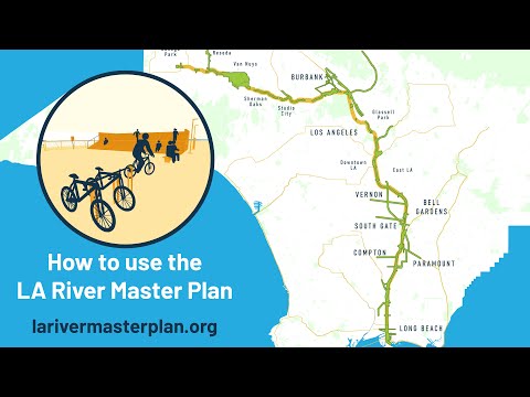
A multi-year effort to revitalize the Los Angeles River took a big step forward a few days ago when the county of Los Angeles released the draft version of the updated Los Angeles River Master Plan. The nearly 500-page document details the needs of the communities along the river, the geographical and environmental constraints that need to be considered when addressing those needs, and the potential opportunities and projects that can help to rejuvenate the 51-mile waterway.
One of the ideas detailed in the Master Plan is the development of elevated platform parks which would cover portions of the river to create new spaces for parks. Such parks are conceptually similar to cap parks that have been built over segments of freeways. However, the notion of elevated platform parks is proofing to be controversial, with some environmental groups already stating their objection. The groups want the plan to focus on the naturalization of the river and are against parks created on giant concrete planks and girders, even if they would support a lush landscape of trees, grass, scenic ponds, horse trails, and walking paths.
To review the draft Master Plan, please visit the project website.
FULL STORY: Frank Gehry proposes capping parts of the LA River with elevated platform parks


'Transformative' pedestrian bridge planned for LA River in Glendale Narrows
A new bridge will link Griffith Park and the Glendale Narrows Riverwalk.

Annual LA River CleanUp Invites Residents to Protect Local Ecosystems
The Friends of the Los Angeles River will host its 34th Annual LA River CleanUp on October 5, inviting residents to help beautify the river, prevent litter from reaching the ocean, and promote equitable access to green spaces.
Revitalizing Sepulveda Basin: A Green Vision for An Urban Oasis
Developed through the input of thousands of community members, this is the first comprehensive plan by the City of Los Angeles for the 2,000-acre basin.

Planetizen Federal Action Tracker
A weekly monitor of how Trump’s orders and actions are impacting planners and planning in America.

The state-sanctioned urbicide of Austin
People don’t kill cities. Freeways do.

US to reduce Colorado River water deliveries to Mexico
A new Colorado Treaty amendment reduces Mexico’s Colorado River water allocation by 250,000 acre feet.

5 New England states march closer to 800 megawatt wind energy project
Securing federal approval for the project may be complicated under the Trump administration, which has historically been hostile towards domestic wind power.

Baltimore to break ground on $50 million Transit Priority Project
The project will bring faster bus trips, safer streets and better bike connections to Baltimore.

Airbnb launches $250 million 'last-dollar financing' housing accelerator, makes first investment in Austin
The company will put $6.4 million towards affordable housing development in Texas’ capital.

FREE Course: Walkable City 1: Why Walkability?
After describing his path towards focusing on walkability as the essence of good planning, Jeff Speck marches through his five principal reasons for making more walkable places.
Reinventing Malls: Planning Alchemy—Turning Gray Fields Into Gold
The course focuses on the opportunities and imperatives that shape reinvention of mall sites.

Eagle County Government
Harvard University Graduate School of Design
Nashville Planning Department
The Architects Foundation
University of Cincinnati Online
The Pocatello Development Authority
The Urban Renewal Agency of the City of Pocatello
Journal of the American Planning Association