


Neighborhoods don't get the same official boundaries as cities, counties, states, and countries. So how do we know where one neighborhood ends and another begins?

Ben Yakas shares news of a made by "meticulous Redditors" to shed some light on the subject of New York City neighborhoods.
The map responds to a severe lack of authoritative neighborhood mapping in the country's most populous city, according to Takas: "No neighborhoods in NYC have any official borders recognized by city or state agencies….But when we're actually out in the city and trying to figure out whether we're eating at a place in DUMBO or Vinegar Hill, it feels somewhat deflating to have to rely on arbitrary real estate demarcations or our digital overlords over at Google Maps to define those boundaries for us."
The article includes a few more fun mapping projects focused on New York City, as well as this video that makes light of a lack of authority on neighborhoods in New York City.
FULL STORY: Interactive Map: How Well Do You Know NYC Neighborhood Boundaries?


Friday Eye Candy: Mapping All of New York's Shadows, in All Seasons
New York's lack of sunlight might be overstated, but the New York Times mapped the shadows cast by every building on every block of the city just to be sure.

Friday Eye Candy: The Theatricality of the Subway
A new book of photography amplifies what was already there.
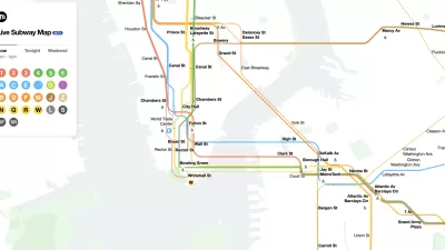
The New New York Subway Map Works in Real Time
There's a new chapter, and maybe an end, for the "Great Subway Map Debate."

Maui's Vacation Rental Debate Turns Ugly
Verbal attacks, misinformation campaigns and fistfights plague a high-stakes debate to convert thousands of vacation rentals into long-term housing.

Planetizen Federal Action Tracker
A weekly monitor of how Trump’s orders and actions are impacting planners and planning in America.

In Urban Planning, AI Prompting Could be the New Design Thinking
Creativity has long been key to great urban design. What if we see AI as our new creative partner?

King County Supportive Housing Program Offers Hope for Unhoused Residents
The county is taking a ‘Housing First’ approach that prioritizes getting people into housing, then offering wraparound supportive services.

Researchers Use AI to Get Clearer Picture of US Housing
Analysts are using artificial intelligence to supercharge their research by allowing them to comb through data faster. Though these AI tools can be error prone, they save time and housing researchers are optimistic about the future.

Making Shared Micromobility More Inclusive
Cities and shared mobility system operators can do more to include people with disabilities in planning and operations, per a new report.
Urban Design for Planners 1: Software Tools
This six-course series explores essential urban design concepts using open source software and equips planners with the tools they need to participate fully in the urban design process.
Planning for Universal Design
Learn the tools for implementing Universal Design in planning regulations.
planning NEXT
Appalachian Highlands Housing Partners
Mpact (founded as Rail~Volution)
City of Camden Redevelopment Agency
City of Astoria
City of Portland
City of Laramie