


New York's lack of sunlight might be overstated, but the New York Times mapped the shadows cast by every building on every block of the city just to be sure.

The New York Times has produced a series of artful maps that illustrates "all of the shadows produced by thousands of buildings in New York City over the course of one day."
Quoctrung Bui and Jeremy White provide the context for the maps, noting that in most parts of America, "sunlight is not debated the way it is in New York, where the city’s thirst for living space, working space and economic growth has turned the sun into a virtual commodity."
Planning, and specifically zoning, has been at the center of the debate for decades, according to the article.
The city’s first attempt at light preservation was through a setback rule. As successive buildings grew taller, they would have to be continually set back a couple of feet from the street (like the Empire State Building), producing the classic wedding-cake style of skyscraper. Decades later, in the 1960s, the city overhauled this rule in favor of a floor-area ratio model, which tended to produce tall, narrow structures with open plazas at the base (like the Seagram Building).
The article includes three maps, presenting the variations between the seasons.
FULL STORY: Mapping the Shadows of New York City: Every Building, Every Block


Friday Eye Candy: A Sorely-Needed Map of New York City Neighborhoods
Neighborhoods don't get the same official boundaries as cities, counties, states, and countries. So how do we know where one neighborhood ends and another begins?

Friday Eye Candy: The Theatricality of the Subway
A new book of photography amplifies what was already there.
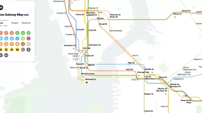
The New New York Subway Map Works in Real Time
There's a new chapter, and maybe an end, for the "Great Subway Map Debate."

Planetizen Federal Action Tracker
A weekly monitor of how Trump’s orders and actions are impacting planners and planning in America.

Vehicle-related Deaths Drop 29% in Richmond, VA
The seventh year of the city's Vision Zero strategy also cut the number of people killed in alcohol-related crashes by half.
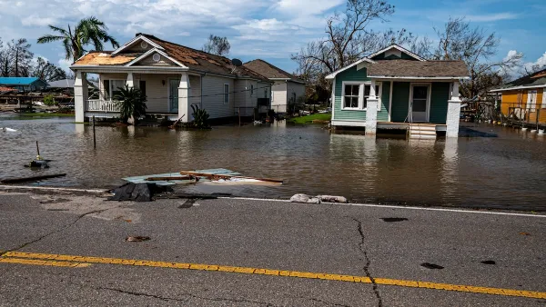
As Trump Phases Out FEMA, Is It Time to Flee the Floodplains?
With less federal funding available for disaster relief efforts, the need to relocate at-risk communities is more urgent than ever.

Berkeley Approves ‘Middle Housing’ Ordinance
The city that invented single-family zoning is finally reckoning with its history of exclusion.

SEPTA Budget Slashes Service by 45 Percent
The Philadelphia-area transit agency is legally tasked with maintaining a balanced budget. Officials hope the state will come to the rescue with additional funding.

Connecticut Governor Vetoes Housing Bill
Gov. Lamont reversed his view on a controversial affordable housing bill that would have required municipalities to zone for set amounts of affordable housing to receive state funding.
Urban Design for Planners 1: Software Tools
This six-course series explores essential urban design concepts using open source software and equips planners with the tools they need to participate fully in the urban design process.
Planning for Universal Design
Learn the tools for implementing Universal Design in planning regulations.
Heyer Gruel & Associates PA
JM Goldson LLC
Custer County Colorado
City of Camden Redevelopment Agency
City of Astoria
Transportation Research & Education Center (TREC) at Portland State University
Camden Redevelopment Agency
City of Claremont
Municipality of Princeton (NJ)