


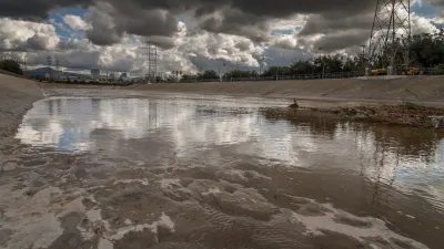
Wildfires in California are getting both larger and more destructive. A simple but informative graphic from the San Francisco illustrates the scope of the destruction.

The Digital Team at the San Francisco Chronicle is helping readers understand the immense size of the largest fire currently burning in North California, the Kincade Fire, as well as the massive size of fires that have burned through the state in recent years.
Providing context, and smaller than every single fire is the city of San Francisco, famously (but erroneously) measured seven miles by seven miles for a total of 49 square miles. It should be noted that San Francisco is not the location of any of the current wildfires, like a post by Time magazine suggested yesterday.
Correction: As fires continue to ravage different parts of California, watch as firefighters face massive flames in Sonoma County. A previous version of this video misstated the location of this fire. It is in Sonoma County, not San Francisco. pic.twitter.com/LHerVw1sP5
— TIME (@TIME) October 29, 2019
For more perspective on California's fires, see also an article by Alissa Walker that reminds California's critics of the state's role as a leader on climate change, with proof in the form of reduced carbon emissions.
FULL STORY: Maps: How SF compares in size to California’s largest wildfires

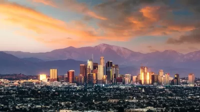
From Planning to Action: How LA County Is Rethinking Climate Resilience
Chief Sustainability Officer Rita Kampalath outlines the County’s shift from planning to implementation in its climate resilience efforts, emphasizing cross-departmental coordination, updated recovery strategies, and the need for flexible funding.
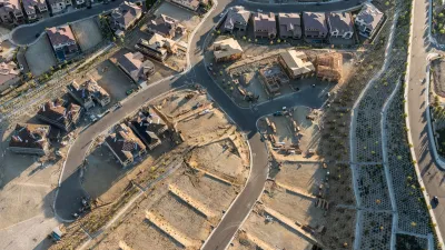
Report Outlines Strategies for Resilient Wildfire Recovery in LA
Project Recovery offers a roadmap for rebuilding more sustainable and climate-resilient communities after wildfires and other disasters.
Building Resilient Communities: Insights from the LA County Cities Summit
The Los Angeles County Cities Summit convened local leaders to share strategies for advancing sustainability, addressing climate resilience, extreme heat, and other pressing environmental challenges through policy and community-driven solutions.

Planetizen Federal Action Tracker
A weekly monitor of how Trump’s orders and actions are impacting planners and planning in America.

Maui's Vacation Rental Debate Turns Ugly
Verbal attacks, misinformation campaigns and fistfights plague a high-stakes debate to convert thousands of vacation rentals into long-term housing.

San Francisco Suspends Traffic Calming Amidst Record Deaths
Citing “a challenging fiscal landscape,” the city will cease the program on the heels of 42 traffic deaths, including 24 pedestrians.

Trump Prompts Restructuring of Transportation Research Board in “Unprecedented Overreach”
The TRB has eliminated more than half of its committees including those focused on climate, equity, and cities.

Amtrak Rolls Out New Orleans to Alabama “Mardi Gras” Train
The new service will operate morning and evening departures between Mobile and New Orleans.

The Subversive Car-Free Guide to Trump's Great American Road Trip
Car-free ways to access Chicagoland’s best tourist attractions.
Urban Design for Planners 1: Software Tools
This six-course series explores essential urban design concepts using open source software and equips planners with the tools they need to participate fully in the urban design process.
Planning for Universal Design
Learn the tools for implementing Universal Design in planning regulations.
Heyer Gruel & Associates PA
JM Goldson LLC
Custer County Colorado
City of Camden Redevelopment Agency
City of Astoria
Transportation Research & Education Center (TREC) at Portland State University
Jefferson Parish Government
Camden Redevelopment Agency
City of Claremont