


A compendium of benefits of walkable urban places, put together by Hazel Borys and Kaid Benfield.
"Whether we’re talking equity, affordability, jobs, health, or a list of other pressing topics, every community strives for more effective outcomes from policies to address a broad range of competing demands. The fact that the demands – and the strategies to address them – are competing for time and resources is its own problem, especially in an era of diminishing trust in cities’ and towns’ capacities to deliver on the collective local vision."
"There’s hope, though, in what we’ve learned about bonuses that come with protecting and expanding compact, mixed-use neighborhoods that aren’t auto-dependent. Here’s a fundamental epiphany: The challenges are interconnected. And so are the solution paths."
Borys goes on to connect some of the many dots – or data points – painstakingly laid out in the cool new tool, Code Score. Lest you be put off by the sound of 135 studies about the paybacks of city planning, know they distill them down to soundbites for you, and deliver them in a couple of ways: paragraph form per topic followed by a bibliography, as well as a downloadable Google Sheet. Their reason why:
"It would be super helpful, would it not, if there was one space on the crowded internet to help us visualize the path between community vision and the strategies and tools for capitalizing on urbanism’s bonuses? And wouldn’t it be great if such a resource also provided a ton of high-quality research to back up the pitch for prioritizing such strategies?"
FULL STORY: Code Score: A New Aid for aligning policy and vision with outcomes

Codes Study: Trends in Zoning Reform
The Codes Study is updated! These are the cities that are rewriting their land use laws to promote wellness, economic strength, and environmental resilience.

3 Good Reasons SimCity Should Adopt a Form-Based Code
And an update from Codes Study about the 600 places that really are upping their game with form-based codes.
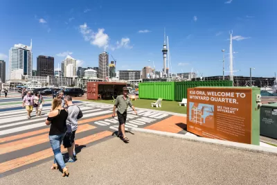
Why Placemaking Matters: What's in it for Me?
What's your elevator pitch on why placemaking matters? Here's a couple rounded up by Hazel Borys, and some numbers that help refine their message.

Planetizen Federal Action Tracker
A weekly monitor of how Trump’s orders and actions are impacting planners and planning in America.

Congressman Proposes Bill to Rename DC Metro “Trump Train”
The Make Autorail Great Again Act would withhold federal funding to the system until the Washington Metropolitan Area Transit Authority (WMATA), rebrands as the Washington Metropolitan Authority for Greater Access (WMAGA).

DARTSpace Platform Streamlines Dallas TOD Application Process
The Dallas transit agency hopes a shorter permitting timeline will boost transit-oriented development around rail stations.

Five Key Transportation Funding Proposals in Trump’s Budget
The President’s proposed 2026 budget would keep spending roughly the same for transit and rail and eliminate over $5 billion in funding for EV charging infrastructure.

LA County Creating Action Plan to Tackle Extreme Heat
Los Angeles County is creating a Heat Action Plan to help communities stay safe during extreme heat, with steps like adding more shade, improving buildings, and supporting the neighborhoods most at risk.

Maryland Plans Quick-Build Complete Streets Projects
The state will use low-cost interventions to improve road safety in five Maryland counties.
Urban Design for Planners 1: Software Tools
This six-course series explores essential urban design concepts using open source software and equips planners with the tools they need to participate fully in the urban design process.
Planning for Universal Design
Learn the tools for implementing Universal Design in planning regulations.
City of Charlotte
Municipality of Princeton
Roanoke Valley-Alleghany Regional Commission
City of Camden Redevelopment Agency
City of Astoria
Transportation Research & Education Center (TREC) at Portland State University
US High Speed Rail Association
City of Camden Redevelopment Agency
Municipality of Princeton (NJ)