


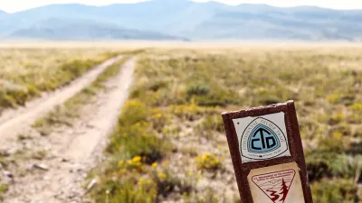
Jefferson County is improving safe access to Rocky Flats National Wildlife Refuge with new trails, a bridge, and signage, as part of the Rocky Mountain Greenway project, ensuring environmental safety and educating visitors about the site’s history.
Jefferson County, in partnership with several regional governments, is advancing the Rocky Mountain Greenway (RMG) project to improve safety and connectivity to the Rocky Flats National Wildlife Refuge (RFNWR). Funded largely through a 2016 Federal Lands Access Program (FLAP) grant, the project includes the construction of a bridge over Indiana Street and an underpass on Colorado Highway 128 to connect RFNWR with nearby public open spaces in Boulder and Jefferson Counties. These improvements are intended to make access safer for pedestrians and cyclists while supporting regional trail connectivity.
Given the site’s history as a former U.S. nuclear weapons production facility, Jefferson County Open Space (JCOS) relied on environmental safety assurances from the Environmental Protection Agency (EPA) and the Colorado Department of Public Health and Environment (CDPHE). Independent soil sampling confirmed that the site is safe for public use. To further mitigate risk, the new trails will be surfaced with offsite materials, helping reduce dust, erosion, and soil disturbance while encouraging visitors to stay on designated paths that also protect local wildlife and habitats.
The project also includes interpretive signage at RFNWR entrances to inform visitors about the site’s complex past, helping them make informed decisions about visiting. A key safety feature is the bridge over Indiana Street—built by the Federal Highway Administration—which replaces a dangerous road crossing with limited visibility. With 83% of project costs covered by federal funding and a 17% local match from JCOS, the RMG continues to fulfill its original vision as part of President Obama’s America’s Great Outdoors initiative to expand equitable access to public lands.
FULL STORY: Greenway to Improve Safety for Visitors to Rocky Flats National Wildlife Refuge

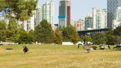
Study: How Urban Parks Can Support Biodiversity
Conservation and recreation can go hand in hand in urban green spaces designed to serve both humans and local wildlife.
BLM To Rescind Public Lands Rule
The change will downgrade conservation, once again putting federal land at risk for mining and other extractive uses.

Harnessing the Power of Fungi for Environmental Cleanup
Mycoremediation — the use of fungi to break down or absorb environmental pollutants — offers a promising, cost-effective, and eco-friendly alternative to conventional methods for restoring contaminated sites.

Planetizen Federal Action Tracker
A weekly monitor of how Trump’s orders and actions are impacting planners and planning in America.

Maui's Vacation Rental Debate Turns Ugly
Verbal attacks, misinformation campaigns and fistfights plague a high-stakes debate to convert thousands of vacation rentals into long-term housing.

San Francisco Suspends Traffic Calming Amidst Record Deaths
Citing “a challenging fiscal landscape,” the city will cease the program on the heels of 42 traffic deaths, including 24 pedestrians.

Amtrak Rolls Out New Orleans to Alabama “Mardi Gras” Train
The new service will operate morning and evening departures between Mobile and New Orleans.

The Subversive Car-Free Guide to Trump's Great American Road Trip
Car-free ways to access Chicagoland’s best tourist attractions.

San Antonio and Austin are Fusing Into one Massive Megaregion
The region spanning the two central Texas cities is growing fast, posing challenges for local infrastructure and water supplies.
Urban Design for Planners 1: Software Tools
This six-course series explores essential urban design concepts using open source software and equips planners with the tools they need to participate fully in the urban design process.
Planning for Universal Design
Learn the tools for implementing Universal Design in planning regulations.
Heyer Gruel & Associates PA
JM Goldson LLC
Custer County Colorado
City of Camden Redevelopment Agency
City of Astoria
Transportation Research & Education Center (TREC) at Portland State University
Jefferson Parish Government
Camden Redevelopment Agency
City of Claremont