


Annapolis has launched an interactive Tree Canopy Map to engage residents in urban forestry efforts, highlighting tree coverage data and encouraging community involvement to achieve the city’s 50 percent canopy goal by 2050.
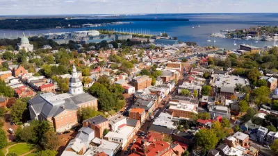
The City of Annapolis has introduced a new interactive Tree Canopy Map, aiming to engage residents in enhancing and sustaining the city's urban forest. This publicly accessible tool provides detailed information on individual street trees, including species, size, and environmental contributions such as carbon sequestration and stormwater reduction. By exploring the map, users can identify areas with sparse tree coverage and contribute to strategic planting efforts.
Developed in collaboration with PlanIT Geo, a leader in urban forestry software and consulting, the Tree Canopy Map allows residents to compare canopy coverage across different neighborhoods. This feature helps pinpoint regions that would benefit from additional tree planting, supporting the city's goal of achieving a 50 percent tree canopy by 2050. Currently, Annapolis stands at approximately 42 percent coverage, highlighting the need for community involvement to reach this target.
City officials emphasize the importance of public participation, noting that much of the available space for new trees is on residential properties. Urban Forester Brian Adams stated, "We need the public’s help to meet our tree canopy goals." Residents are encouraged to utilize the Tree Canopy Map to assess their neighborhoods and consider planting suitable trees, thereby contributing to a healthier and more resilient urban environment.
FULL STORY: Annapolis Launches Interactive Tree Canopy Map to Support Urban Forestry Efforts

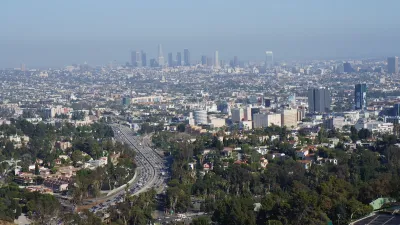
Updating LA’s Tree Rules Could Bring More Shade to Underserved Neighborhoods
A new USC study finds that relaxing Los Angeles’ outdated tree planting guidelines could significantly expand urban tree canopy and reduce shade disparities in lower-income neighborhoods, though infrastructure investments are also needed.
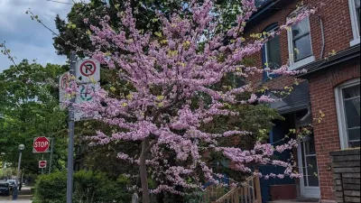
The Most Popular Tree on Google?
Meet Rodney: the Toronto tree getting rave reviews.
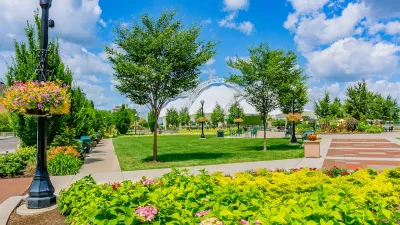
A Plan to Expand Tree Canopy Across Dayton
Dayton is developing an urban forest master plan, using a $2 million grant to expand its tree canopy, address decades of tree loss, and enhance environmental equity across the city.

Planetizen Federal Action Tracker
A weekly monitor of how Trump’s orders and actions are impacting planners and planning in America.

Congressman Proposes Bill to Rename DC Metro “Trump Train”
The Make Autorail Great Again Act would withhold federal funding to the system until the Washington Metropolitan Area Transit Authority (WMATA), rebrands as the Washington Metropolitan Authority for Greater Access (WMAGA).

The Simple Legislative Tool Transforming Vacant Downtowns
In California, Michigan and Georgia, an easy win is bringing dollars — and delight — back to city centers.

Albuquerque’s Microtransit: A Planner’s Answer to Food Access Gaps
New microtransit vans in Albuquerque aim to close food access gaps by linking low-income areas to grocery stores, cutting travel times by 30 percent and offering planners a scalable model for equity-focused transit.

This City Will Pay You to Meet Your Neighbors
A North Kansas City grant program offers up to $400 for residents to throw neighborhood block parties.

Commentary: Our Silence Will Not Protect Us
Keeping our heads down and our language inoffensive is not the right response to the times we’re in. Solidarity and courage is.
Urban Design for Planners 1: Software Tools
This six-course series explores essential urban design concepts using open source software and equips planners with the tools they need to participate fully in the urban design process.
Planning for Universal Design
Learn the tools for implementing Universal Design in planning regulations.
Smith Gee Studio
City of Charlotte
City of Camden Redevelopment Agency
City of Astoria
Transportation Research & Education Center (TREC) at Portland State University
US High Speed Rail Association
City of Camden Redevelopment Agency
Municipality of Princeton (NJ)