


Lewisville, Texas, demonstrates how equitable planning and community-driven efforts can transform underserved areas by enhancing park access and promoting social and recreational equity.

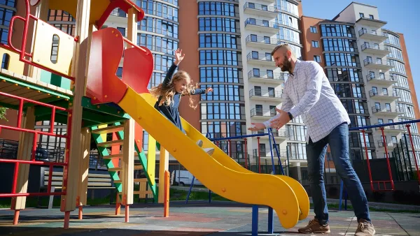
The 10-Minute Walk campaign, a nationwide initiative led by the Urban Land Institute, the National Recreation and Park Association, and The Trust for Public Land, aims to ensure all residents live within a 10-minute walk of a park. In Lewisville, Texas, this vision became reality through a study focused on increasing park access in underserved areas like "the Triangle," which faced barriers such as busy roadways and socioeconomic challenges. By leveraging data, mapping, and authentic community engagement, the city developed a plan to address these disparities and foster equity in park access.
Two standout achievements emerged from Lewisville's efforts. The Play Lewisville On Wheels program brought recreation directly to underserved neighborhoods, eliminating barriers such as transportation and cost. Similarly, the creation of Glory Park/Parque La Gloria improved the Triangle neighborhood, providing walking trails, playgrounds, and open spaces while fostering trust and social connections through a community-driven planning process. These initiatives not only enhanced recreational opportunities but also strengthened community bonds and inspired further improvements.
As a result, Lewisville has made significant progress, increasing the percentage of residents living within a 10-minute walk of a park from 60% in 2019 to 83% by 2024, with a goal of 85% by 2025. The success of Lewisville's approach underscores the importance of prioritizing equity, engaging communities authentically, and translating thoughtful plans into tangible actions. By doing so, the city has set a powerful example for advancing equitable access to parks nationwide.
FULL STORY: From Plans to Parks: Learning from Lewisville


Exposition Park’s $351.5 Million Transformation
This revitalization will create vital green spaces, improve accessibility, and enhance connections with community, making Exposition Park a central hub for recreation and culture in Los Angeles.

How Public Spaces Exclude Teen Girls
Adolescent girls face unique challenges and concerns when navigating public spaces. We can design cities with their needs in mind.
Quantifying Social Infrastructure
New developments have clear rules for ensuring surrounding roads, water, and sewers can handle new users. Why not do the same for community amenities?

Maui's Vacation Rental Debate Turns Ugly
Verbal attacks, misinformation campaigns and fistfights plague a high-stakes debate to convert thousands of vacation rentals into long-term housing.

Planetizen Federal Action Tracker
A weekly monitor of how Trump’s orders and actions are impacting planners and planning in America.

In Urban Planning, AI Prompting Could be the New Design Thinking
Creativity has long been key to great urban design. What if we see AI as our new creative partner?

King County Supportive Housing Program Offers Hope for Unhoused Residents
The county is taking a ‘Housing First’ approach that prioritizes getting people into housing, then offering wraparound supportive services.

Researchers Use AI to Get Clearer Picture of US Housing
Analysts are using artificial intelligence to supercharge their research by allowing them to comb through data faster. Though these AI tools can be error prone, they save time and housing researchers are optimistic about the future.

Making Shared Micromobility More Inclusive
Cities and shared mobility system operators can do more to include people with disabilities in planning and operations, per a new report.
Urban Design for Planners 1: Software Tools
This six-course series explores essential urban design concepts using open source software and equips planners with the tools they need to participate fully in the urban design process.
Planning for Universal Design
Learn the tools for implementing Universal Design in planning regulations.
planning NEXT
Appalachian Highlands Housing Partners
Mpact (founded as Rail~Volution)
City of Camden Redevelopment Agency
City of Astoria
City of Portland
City of Laramie