


An advocacy group is calling for ‘sustainable, vertical’ mixed-use urbanism in the famously sprawling city.
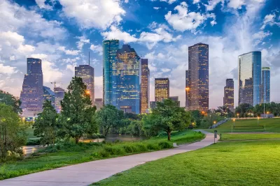
The Texas chapter of the Council on Tall Buildings and Urban Habitat (CTBUH) is calling for increased density in Houston after a survey revealed that roughly 60 percent of respondents want the opportunity to live in a mixed-use development, favoring them over single-family homes.
Urban Edge’s John Brannen spoke with CTBUH’s leader, Mide Akinsade. According to Akinsade, “As part of city formation, the automobile has had the most impact in terms of urban sprawl. Unfortunately, it’s not sustainable because we’re creating all these impervious surfaces of roads. We have so many highways and the city is so vast.”
Akinsade says that the group is looking for “sustainable, vertical urbanism.” While the vertical part exists in Houston, the city still has little diversity in land use, forcing residents to travel farther to meet different needs. “It’s that kind of attitude and overlaying it with sustainability. When you’re walking you want to walk in shaded streets. You want to have pocket parks. That’s what is at the root of what I’m trying to bring to Houston.” Akinsade also points to the city’s many bayou waterfronts as an underdeveloped asset. “Those should be the city’s playground,” Akinsade said, adding, “I understand the ebb and flow of the bayou and the amount of capital that might need to be invested.”
FULL STORY: Tall building council looks upward to support a more walkable, sustainable Houston

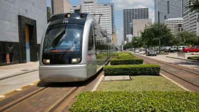
Two Studies Show How Light Rail Benefits Houston
Finally, the city seems to be reaping benefits from a major investment in public transportation.
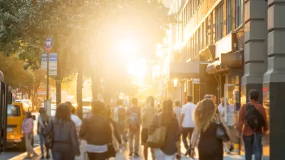
Density and Disorder: The Imaginary Link
A recent article tries to tie public transit and walkability to social disorder — but in fact, sprawling Sunbelt cities like Memphis are as likely to have high crime rates as transit-rich metropolises such as New York and San Francisco.
Opinion: Conservation and Affordable Housing Can Coexist
Encouraging denser development in urbanized areas is an effective way to protect sensitive flora and fauna from human encroachment.

Planetizen Federal Action Tracker
A weekly monitor of how Trump’s orders and actions are impacting planners and planning in America.

Maui's Vacation Rental Debate Turns Ugly
Verbal attacks, misinformation campaigns and fistfights plague a high-stakes debate to convert thousands of vacation rentals into long-term housing.

San Francisco Suspends Traffic Calming Amidst Record Deaths
Citing “a challenging fiscal landscape,” the city will cease the program on the heels of 42 traffic deaths, including 24 pedestrians.

Defunct Pittsburgh Power Plant to Become Residential Tower
A decommissioned steam heat plant will be redeveloped into almost 100 affordable housing units.

Trump Prompts Restructuring of Transportation Research Board in “Unprecedented Overreach”
The TRB has eliminated more than half of its committees including those focused on climate, equity, and cities.

Amtrak Rolls Out New Orleans to Alabama “Mardi Gras” Train
The new service will operate morning and evening departures between Mobile and New Orleans.
Urban Design for Planners 1: Software Tools
This six-course series explores essential urban design concepts using open source software and equips planners with the tools they need to participate fully in the urban design process.
Planning for Universal Design
Learn the tools for implementing Universal Design in planning regulations.
Heyer Gruel & Associates PA
JM Goldson LLC
Custer County Colorado
City of Camden Redevelopment Agency
City of Astoria
Transportation Research & Education Center (TREC) at Portland State University
Jefferson Parish Government
Camden Redevelopment Agency
City of Claremont