


A new program uses sensors to detect how people move and using which modes, but road safety advocates argue the city already knows how to make streets safer for vulnerable users.
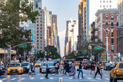
A New York City pilot program uses a new type of streetlight-mounted sensor to track how people get around the city in order to better understand mobility patterns and inform transportation planning decisions, writes Alissa Waker in Curbed.
“The sensors sort movement into one of nine modes: pedestrian, bike, e-scooter, motorcycle, car, van, light truck, semi-truck, and bus,” revealing an interesting set of patterns often invisible to casual observers. Like paths etched into snowy streets, the sensor maps show “desire lines,” the paths that pedestrians, cyclists, and other road users take to make travel more convenient that may not align with existing infrastructure. “And instead of waiting for real-world crash data should two modes collide, the sensor’s ability to track near misses — where two paths almost cross but don’t — has the potential to identify a dangerous spot before someone gets hurt.”
The program was implemented because “Understanding how people use streets is crucial information for transportation planners to recommend adaptive changes (a wider bike lane, a mid-block crosswalk), but the accuracy of the tools the city uses to capture these patterns of movement varies widely from pneumatic tubes on the ground to observational hand counts.” But as Walker points out, “the city already knows a lot about how to proactively prevent crashes: by slowing drivers down and making more space for pedestrians, cyclists, and transit riders. New data, even with the capacity to track such granular contortions of movement, won’t do much to make people feel safer if the city continues to drag its feet on how it implements its own stated goals for fixing its streetscapes.”
FULL STORY: A New Way to Track How the City Moves

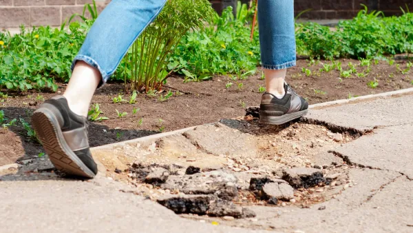
Portland Council Tentatively Approves Sidewalk Repair Plan
The proposal would address sidewalk needs in Portland’s District 1 and District 4.
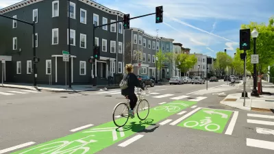
NACTO Releases Updated Urban Bikeway Guide
The third edition of the nationally recognized road design guide includes detailed design advice for roads that prioritize safety and accessibility for all users.

Chicago Allocates $500K to Sidewalk Clearing Pilot
Advocates of the Plow the Sidewalks program were asking for $1 million to start a pilot program in four areas of the city.

Maui's Vacation Rental Debate Turns Ugly
Verbal attacks, misinformation campaigns and fistfights plague a high-stakes debate to convert thousands of vacation rentals into long-term housing.

Planetizen Federal Action Tracker
A weekly monitor of how Trump’s orders and actions are impacting planners and planning in America.

Chicago’s Ghost Rails
Just beneath the surface of the modern city lie the remnants of its expansive early 20th-century streetcar system.

Bend, Oregon Zoning Reforms Prioritize Small-Scale Housing
The city altered its zoning code to allow multi-family housing and eliminated parking mandates citywide.

Amtrak Cutting Jobs, Funding to High-Speed Rail
The agency plans to cut 10 percent of its workforce and has confirmed it will not fund new high-speed rail projects.

LA Denies Basic Services to Unhoused Residents
The city has repeatedly failed to respond to requests for trash pickup at encampment sites, and eliminated a program that provided mobile showers and toilets.
Urban Design for Planners 1: Software Tools
This six-course series explores essential urban design concepts using open source software and equips planners with the tools they need to participate fully in the urban design process.
Planning for Universal Design
Learn the tools for implementing Universal Design in planning regulations.
planning NEXT
Appalachian Highlands Housing Partners
Mpact (founded as Rail~Volution)
City of Camden Redevelopment Agency
City of Astoria
City of Portland
City of Laramie