


Los Angeles County just broke ground on a $41 million stormwater capture project at Adventure Park in Whittier.

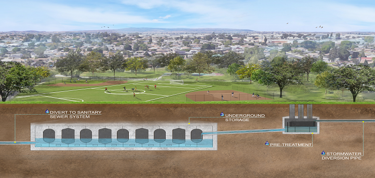
The proposed Adventure Park Multi-Benefit Stormwater Capture Project, located in the unincorporated community of South Whittier, will help improve water quality in Coyote Creek and the San Gabriel River while offering various community benefits. The project involves the construction of new drainage infrastructure to capture and treat stormwater and enhancements to the park, including drought-tolerant landscaping with educational signs, new exercise equipment, walking paths, and renovated sports fields.
As Susan Carpenter reports, the $41.2 million project is partly funded with property tax revenues generated through Measure W, the LA County ballot initiative voters approved in 2018. The Safe Clean Water Program, as it is also known, taxes property owners within the LA County Flood Control District 2.5 cents per square foot of impermeable surface area. Those funds are then used to increase local water supplies and improve water quality. Annually, the countywide program generates as much as $285 million.
Adventure Park will be closed while the stormwater capture project is under construction. It will take about two years to build the underground storage system and upgrade the facilities above ground, during which time residents may visit nearby Mayberry and Sorensen Parks.
FULL STORY: LA County breaks ground on $41 million stormwater capture project in Whittier


Los Angeles County Making Progress in Stormwater Capture
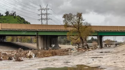
During this “super year” of storms, L.A. County has successfully captured 96 billion gallons of stormwater which is enough to meet the needs of about 2.4 million people a year.
Downpours Yield 33 Billion Gallons of Captured Stormwater in L.A. County
County officials hope reclamation efforts will help the region reduce its dependence on imported water supplies.
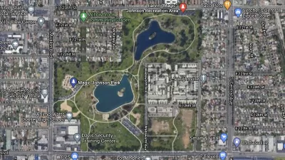
South Los Angeles Park Offers Hidden Benefits
Not only does the redevelopment of a large section of Earvin Magic Johnson Park in Willowbrook offer much needed green space and new amenities, it also helps to conserve water and improve water quality.

Maui's Vacation Rental Debate Turns Ugly
Verbal attacks, misinformation campaigns and fistfights plague a high-stakes debate to convert thousands of vacation rentals into long-term housing.

Planetizen Federal Action Tracker
A weekly monitor of how Trump’s orders and actions are impacting planners and planning in America.

San Francisco Suspends Traffic Calming Amidst Record Deaths
Citing “a challenging fiscal landscape,” the city will cease the program on the heels of 42 traffic deaths, including 24 pedestrians.

Bend, Oregon Zoning Reforms Prioritize Small-Scale Housing
The city altered its zoning code to allow multi-family housing and eliminated parking mandates citywide.

Amtrak Cutting Jobs, Funding to High-Speed Rail
The agency plans to cut 10 percent of its workforce and has confirmed it will not fund new high-speed rail projects.

LA Denies Basic Services to Unhoused Residents
The city has repeatedly failed to respond to requests for trash pickup at encampment sites, and eliminated a program that provided mobile showers and toilets.
Urban Design for Planners 1: Software Tools
This six-course series explores essential urban design concepts using open source software and equips planners with the tools they need to participate fully in the urban design process.
Planning for Universal Design
Learn the tools for implementing Universal Design in planning regulations.
planning NEXT
Appalachian Highlands Housing Partners
Mpact (founded as Rail~Volution)
City of Camden Redevelopment Agency
City of Astoria
City of Portland
City of Laramie