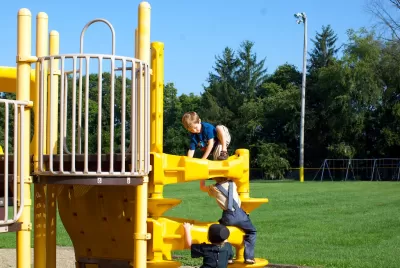
Data analysis and research by national organizations are helping to ensure equitable distribution and provision of parks and recreational facilities.

The field of parks and recreation is increasingly becoming more data-driven, with data helping to inform planning, decision-making, and resource allocation. This article by Kurt Buss discusses how data analysis and research by three national organizations, including the National Recreation and Park Association (NRPA), the Trust for Public Land (TPL), and the National Association of Realtors (NAR), are being used to ensure and support the equitable distribution and provision of parks in communities across the country. Specifically, the following resources are highlighted:
- NRPA Park Metrics: This is the most comprehensive source of data standards and insights for park and recreation agencies. Launched in 2009, these agency performance resources assist park and recreation professionals in the effective management and planning of their operating resources and capital facilities. This suite of tools allows park and recreation agencies to build customized reports that allow for comparisons with peer agencies. Park and recreation professionals can use this benchmark data to gain more funding support, improve operations and better serve their communities.
- TPL ParkScore®: This index is the national gold-standard comparison of park systems across the 100 most-populated cities in the U.S. Along with these 100 cities, the data behind the index also reveals park access levels for nearly 14,000 cities, towns, and communities. To determine a city’s ParkScore rating, TPL assigns points for 14 measures across five categories: acreage, investment, amenities, access, and equity. For each of the 14 measures, points are awarded on a relative basis, based on how a city compares to the 100 largest U.S. cities.
- NAR Community Preferences Surveys: NAR has conducted community preferences surveys, in one form or another for 20 years, providing realtors and local communities with important information about changes and helping them advocate for smart growth strategies in response to those shifts. According to the 2020 Community Preference Survey, more than three fourths of all respondents want to be within an easy walk to a park and 53 percent believe it is important to be close to paths. Also, over half of them would be willing to pay more to buy a house within walking distance to amenities, such as parks.
For details, please read the source article.
FULL STORY: Equitable Park Planning, and the Role of Big Data

Planetizen Federal Action Tracker
A weekly monitor of how Trump’s orders and actions are impacting planners and planning in America.

Maui's Vacation Rental Debate Turns Ugly
Verbal attacks, misinformation campaigns and fistfights plague a high-stakes debate to convert thousands of vacation rentals into long-term housing.

Restaurant Patios Were a Pandemic Win — Why Were They so Hard to Keep?
Social distancing requirements and changes in travel patterns prompted cities to pilot new uses for street and sidewalk space. Then it got complicated.

In California Battle of Housing vs. Environment, Housing Just Won
A new state law significantly limits the power of CEQA, an environmental review law that served as a powerful tool for blocking new development.

Boulder Eliminates Parking Minimums Citywide
Officials estimate the cost of building a single underground parking space at up to $100,000.

Orange County, Florida Adopts Largest US “Sprawl Repair” Code
The ‘Orange Code’ seeks to rectify decades of sprawl-inducing, car-oriented development.
Urban Design for Planners 1: Software Tools
This six-course series explores essential urban design concepts using open source software and equips planners with the tools they need to participate fully in the urban design process.
Planning for Universal Design
Learn the tools for implementing Universal Design in planning regulations.
Heyer Gruel & Associates PA
JM Goldson LLC
Custer County Colorado
City of Camden Redevelopment Agency
City of Astoria
Transportation Research & Education Center (TREC) at Portland State University
Jefferson Parish Government
Camden Redevelopment Agency
City of Claremont


