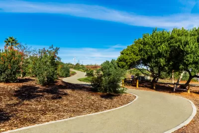
Trails play a vital role in encouraging and facilitating outdoor recreation that contributes to the health and well-being of residents and visitors alike.

Are trails just lines randomly drawn on maps? While some people may perceive them this way, trail planners would most certainly disagree because of the thoughtfulness and care with which they approach their work. Trail planning is an underappreciated field that is complex and challenging. Aside from the few publications dedicated to trails, little is written about trail planning and the planners who are devoted to this increasingly important work due to the growing popularity of trails. According to recent Outdoor Participation Reports released by the Outdoor Industry Association, trail running, hiking, and mountain biking are among the most popular outdoor activities in the U.S. in terms of both participation rate and frequency of participation.
Recognizing that trails are critical components of the region’s park and recreation system, the Los Angeles County Department of Parks and Recreation (DPR) has been involved in trail planning, development, and maintenance for a long time. A dedicated Trails Planning Section works on a wide range of multi-use trail planning projects that serve hikers, equestrians, and mountain bikers in a variety of settings, including rural, suburban, and urban areas.
DPR is responsible for master planning the county’s regional trail system, which is mapped and included in the Parks and Recreation Element of the L.A. County General Plan. It also maintains the Trails Manual, which provides guidance on trail planning, design, development, operations, and maintenance. In addition, the Trails Planning Section has completed trails master plans for various areas, including Castaic and Santa Susana Mountains, located in the northern part of the county.
DPR has also developed an updated trails website and a new Trails LA County mobile app. The website and new mobile app promote the use of trails and inform the public of the value and importance of stewardship, conservation, and habitat restoration of open space. With its enhanced functionalities, the website is intended to be the go-to online resource for the public to find official trail information throughout the county, while the new mobile app provides an on-the-go experience. Both the website and app offer digital tools, including information on real-time alerts, maps, weather, trail length, elevation, difficulty level, rest stops, picnic locations, and much more.
For more information, please visit the Trails LA County website and read this article.
FULL STORY: County Parks, Recreation Encourages Use of Public Trails

Planetizen Federal Action Tracker
A weekly monitor of how Trump’s orders and actions are impacting planners and planning in America.

Maui's Vacation Rental Debate Turns Ugly
Verbal attacks, misinformation campaigns and fistfights plague a high-stakes debate to convert thousands of vacation rentals into long-term housing.

Restaurant Patios Were a Pandemic Win — Why Were They so Hard to Keep?
Social distancing requirements and changes in travel patterns prompted cities to pilot new uses for street and sidewalk space. Then it got complicated.

In California Battle of Housing vs. Environment, Housing Just Won
A new state law significantly limits the power of CEQA, an environmental review law that served as a powerful tool for blocking new development.

Boulder Eliminates Parking Minimums Citywide
Officials estimate the cost of building a single underground parking space at up to $100,000.

Orange County, Florida Adopts Largest US “Sprawl Repair” Code
The ‘Orange Code’ seeks to rectify decades of sprawl-inducing, car-oriented development.
Urban Design for Planners 1: Software Tools
This six-course series explores essential urban design concepts using open source software and equips planners with the tools they need to participate fully in the urban design process.
Planning for Universal Design
Learn the tools for implementing Universal Design in planning regulations.
Heyer Gruel & Associates PA
JM Goldson LLC
Custer County Colorado
City of Camden Redevelopment Agency
City of Astoria
Transportation Research & Education Center (TREC) at Portland State University
Jefferson Parish Government
Camden Redevelopment Agency
City of Claremont


