


A new report concludes that common ‘walkability’ measures don’t account for many barriers faced by pedestrians, such as environmental factors and policing.
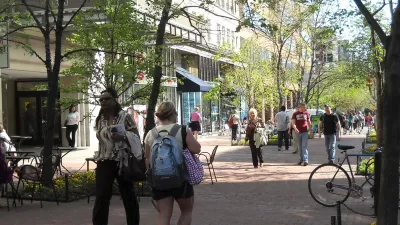
According to Kea Wilson, “if cities truly want to be pedestrian-friendly, they need to think beyond the sidewalk, particularly in neighborhoods of color that face the steepest barriers.” However, while walkability scoring tools attempt to quantify the accessibility of neighborhoods for pedestrians, they leave out important factors. “That’s mostly because walkability algorithms tend to grade neighborhoods highly when they offer a lot of destinations within ‘walking distance,‘ but don’t closely scrutinize things like pedestrian crash rates, how long it takes to cross the road, the presence or absence of sidewalks, or even whether or not people you know, actually walk in a given neighborhood right now.”
A new analysis from the Urban Institute used five criteria to get a more accurate picture of actual walkability in Washington, D.C.: access to “essential destinations,” environmental quality factors such as air pollution and shade, infrastructure, policing, and road safety. “The study focused on data that could be sourced from public sources in hopes that other cities could easily replicate their work, but the researchers were forced to leave out certain critical and under-studied walking barriers, like rates of gender-based street harassment, accessibility for people with disabilities, and flood patterns in communities with poor drainage.”
“Still, the researchers say that’s all the more reason for city leaders to expand the kinds of data they collect on mobility barriers among various groups — and to think just as broadly about how improving one metric, like the prevalence of ‘self-enforcing’ street designs, could possibly improve other metrics, like decreasing the number of police stops.”
FULL STORY: Why ‘Walkability’ Scores Don’t Tell Us How Pedestrian-Friendly a City Is For Everyone

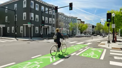
NACTO Releases Updated Urban Bikeway Guide
The third edition of the nationally recognized road design guide includes detailed design advice for roads that prioritize safety and accessibility for all users.
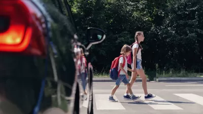
US Street Design Manual Inches Toward Safer Roads
The guiding document for U.S. road design is starting to recognize the needs of people walking and biking, but safe streets advocates say more significant changes are needed to reduce the high number of pedestrian deaths and improve connectivity for all road users.

Houston Developers Question Mayor’s Stance on Pedestrian Projects
The new mayor’s reversal of road safety projects, some already underway or completed, is raising eyebrows among developers who say residents want walkable, mixed-use streets.

Planetizen Federal Action Tracker
A weekly monitor of how Trump’s orders and actions are impacting planners and planning in America.

USGS Water Science Centers Targeted for Closure
If their work is suspended, states could lose a valuable resource for monitoring, understanding, and managing water resources.
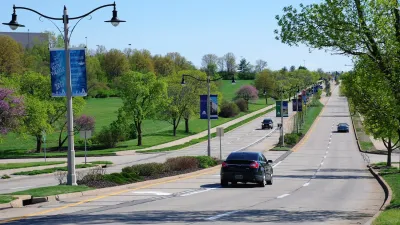
End Human Sacrifices to the Demanding Gods of Automobile Dependency and Sprawl
The U.S. has much higher traffic fatality rates than peer countries due to automobile dependency and sprawl. Better planning can reduce these human sacrifices.

Trump: Federal Government Won’t Pay for California HSR
The President has targeted federal funding for the California bullet train project since his first administration.

San Francisco Enhances Urban Planning Initiatives with Green Infrastructure
San Francisco incorporates green infrastructure in its city development initiatives, elevating the importance of sustainability in urban planning.

Chicago Approves Green Affordable Housing Plan
The Mayor’s plan calls for creating a nonprofit housing corporation tasked with building affordable housing that meets Green Building standards.
Urban Design for Planners 1: Software Tools
This six-course series explores essential urban design concepts using open source software and equips planners with the tools they need to participate fully in the urban design process.
Planning for Universal Design
Learn the tools for implementing Universal Design in planning regulations.
Tyler Technologies
New York City School Construction Authority
Village of Glen Ellyn
Transportation Research & Education Center (TREC) at Portland State University
Chaddick Institute at DePaul University
Institute for Housing and Urban Development Studies (IHS)
Regional Transportation Commission of Southern Nevada
Toledo-Lucas County Plan Commissions