As more planners begin to question the value of urban freeways, communities that have long borne the negative impacts of highway construction are fighting back with data.


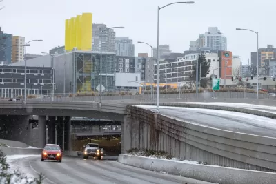
Residents of Seattle's South Park neighborhood are calling on the state to remove a stretch of highway that community members argue creates air and noise pollution and uses valuable urban space that could be developed into housing, parks, or other uses. "More than 90% of South Park residents live near a contaminated site, Superfund project or freight corridor, compared with roughly 60% for the rest of the city." An article by David Kroman describes the efforts of one community advocacy group to pass legislation limiting highway expansion in communities already impacted by them.
"Local communities have, for decades, spoken out about the impacts of highways on where they live. In recent years, researchers have begun to quantify that impact." Washington-based advocacy organization Front and Centered worked with researchers to create a map that illustrates the disparate public health impacts of living in different parts of the state. "When the map was complete, the results were at once shocking and expected. Low-income and diverse communities near highways — in South King County, Tacoma, Yakima — consistently ranked the highest on a scale of 1 to 10, with 10 indicating the most risk. South Park is a 10."
According to the article, Front and Centered is promoting legislation that would use the map to evaluate highway expansion proposals and ban road expansion in areas with high risk ratings. Kroman describes the mixed opinions on the part of state legislators, who support attempts to redress the damage done by urban highways but express concern about goods movement, a key industry in Washington state.
In addition to working to get their legislation passed in a future legislative session, Front and Centered leaders hope the state will conduct a feasibility study to assess the potential for removing Highway 99.
Read the full story: Seattle residents drive movement to tear out Highway 99 in South Park


Seattle Neighborhood Calls for Highway Removal
South Park becomes the latest community to call for the removal of a highway segment that has cut off the neighborhood from local amenities for decades.

California Bill Could Ban Freeway Expansions in Underserved Neighborhoods
A proposed bill in the California State Legislature would bar the state from funding road construction in communities at risk for displacement and health impacts.
Bridging Divides: The Crucial Role of Collaboration in Highway Removal
Highway removal is most successful when agencies at all levels of government work closely with each other and the impacted community.

Planetizen Federal Action Tracker
A weekly monitor of how Trump’s orders and actions are impacting planners and planning in America.

California plans to bury El Niño’s downpour
If the state plays its cards right, it may be able to store a billion acre-feet of El Niño’s water in aquifers.

Desperate measures: Advocates weigh draining Lake Powell to fill Colorado River
Draining the reservoir could reduce evaporation losses by a couple hundred thousand acre-feet.

After public outcry, Massachusetts city releases housing development tracker
Cambridge’s tracker currently shows 250 housing projects in various stages of development.

40 years after approval, Chicago breaks ground on new park
The park honors Jean Baptiste Point du Sable, the city’s first permanent non-native settler.

‘Hoodwinked:’ New Mexico bill aimed at microgrids paves way for data center development
In an interview with High Country News, Padilla said the legislation “ignited” New Mexico's economy.

FREE Course: Walkable City 1: Why Walkability?
After describing his path towards focusing on walkability as the essence of good planning, Jeff Speck marches through his five principal reasons for making more walkable places.
Reinventing Malls: Planning Alchemy—Turning Gray Fields Into Gold
The course focuses on the opportunities and imperatives that shape reinvention of mall sites.

City of Rosemead
Rutgers University, Edward J. Bloustein School of Planning and Public Policy
One Hundred Miles
Hunter College, City University of New York (CUNY)
The Architects Foundation
University of Cincinnati Online
City of Cambridge
Montrose County
The Pocatello Development Authority