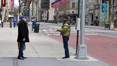
A new study finds that county density is not significantly related to the infection rate, but higher density counties have significantly lower virus-related mortality rates than those with lower densities, possibly due to superior health care.

Problem, research strategy, and findings: The impact of density on emerging highly contagious infectious diseases has rarely been studied. In theory, dense areas lead to more face-to-face interaction among residents, which makes them potential hotspots for the rapid spread of pandemics. On the other hand, dense areas may have better access to health care facilities and greater implementation of social distancing policies and practices. The current COVID-19 pandemic is a perfect case study to investigate these relationships.
A new study by researchers Does Density Aggravate the COVID-19 Pandemic?, published in the Journal of the American Planning Association, uses sophisticated modeling to account for both direct and indirect impacts of density on the COVID-19 infection and mortality rates for 913 U.S. metropolitan counties, controlling for key confounding factors. The results indicate that larger metropolitan areas have higher infection and mortality rates, but after controlling for metropolitan population size, county density is not significantly related to the infection rate, and higher density counties have significantly lower virus-related mortality rates than do those with lower densities, possibly due to superior health care systems.
Takeaway for practice: These findings suggest that connectivity matters more than density in the spread of the COVID-19 pandemic. Large metropolitan areas with a higher number of counties tightly linked together through economic, social, and commuting relationships are the most vulnerable to the pandemic outbreaks. They are more likely to exchange tourists and business people within themselves and with other parts, thus increasing the risk of cross-border infections. This study concludes with a key recommendation that planners continue to advocate dense development for a host of reasons, including lower death rates due to infectious diseases like COVID-19.
FULL STORY: Does Density Aggravate the COVID-19 Pandemic? Early Findings and Lessons for Planners

Planetizen Federal Action Tracker
A weekly monitor of how Trump’s orders and actions are impacting planners and planning in America.

Maui's Vacation Rental Debate Turns Ugly
Verbal attacks, misinformation campaigns and fistfights plague a high-stakes debate to convert thousands of vacation rentals into long-term housing.

San Francisco Suspends Traffic Calming Amidst Record Deaths
Citing “a challenging fiscal landscape,” the city will cease the program on the heels of 42 traffic deaths, including 24 pedestrians.

Defunct Pittsburgh Power Plant to Become Residential Tower
A decommissioned steam heat plant will be redeveloped into almost 100 affordable housing units.

Trump Prompts Restructuring of Transportation Research Board in “Unprecedented Overreach”
The TRB has eliminated more than half of its committees including those focused on climate, equity, and cities.

Amtrak Rolls Out New Orleans to Alabama “Mardi Gras” Train
The new service will operate morning and evening departures between Mobile and New Orleans.
Urban Design for Planners 1: Software Tools
This six-course series explores essential urban design concepts using open source software and equips planners with the tools they need to participate fully in the urban design process.
Planning for Universal Design
Learn the tools for implementing Universal Design in planning regulations.
Heyer Gruel & Associates PA
JM Goldson LLC
Custer County Colorado
City of Camden Redevelopment Agency
City of Astoria
Transportation Research & Education Center (TREC) at Portland State University
Jefferson Parish Government
Camden Redevelopment Agency
City of Claremont


