


For one refugee family, living in Houston has meant facing a host of new challenges as they traverse the city’s roadways without a car.
Peter Holley writes about a family who moved from a refugee camp in Burundi in Central Africa to Houston and their acclimation to life in this city—namely, learning to make their way along treacherous roads on foot.
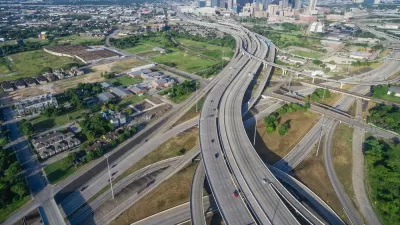
Among Texas cities, Houston stands out for its especially bad sidewalk infrastructure, where crossing busy roadways can be deadly. And the risks are even greater for residents on Houston’s southwest side. Sixty percent of the deadliest intersections are located in this area, and most resettled immigrants live in this part of the city.
"Not only is southwest Houston one of the most car-dependent areas in the nation, it’s also beset by narrow sidewalks in various states of disrepair, limited signage, distracted drivers, and relentless waves of traffic," writes Holley.
FULL STORY: This Family Survived an African Refugee Camp. Their New Challenge: Surviving Houston Without a Car.

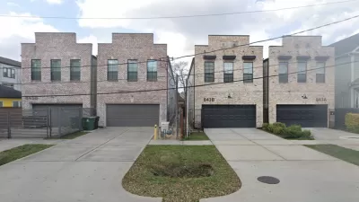
Houston Debates Shared Driveway Requirement
A proposed rule would require developers to build shared driveways for narrow lot projects.

Without Sidewalks, Making Seattle Streets More Pedestrian Friendly
Over a quarter of city blocks lack sidewalk infrastructure. An advocacy project to reduce traffic speeds and increase pedestrian safety on these streets has evolved into a city-funded program.
Houston Metro's Beacons Serve Visually-Impaired Population
A system of beacons will send signals to cell phones in Houston to help bus riders find stops and navigate public transit safely.

Maui's Vacation Rental Debate Turns Ugly
Verbal attacks, misinformation campaigns and fistfights plague a high-stakes debate to convert thousands of vacation rentals into long-term housing.

Planetizen Federal Action Tracker
A weekly monitor of how Trump’s orders and actions are impacting planners and planning in America.

Chicago’s Ghost Rails
Just beneath the surface of the modern city lie the remnants of its expansive early 20th-century streetcar system.

Bend, Oregon Zoning Reforms Prioritize Small-Scale Housing
The city altered its zoning code to allow multi-family housing and eliminated parking mandates citywide.

Amtrak Cutting Jobs, Funding to High-Speed Rail
The agency plans to cut 10 percent of its workforce and has confirmed it will not fund new high-speed rail projects.

LA Denies Basic Services to Unhoused Residents
The city has repeatedly failed to respond to requests for trash pickup at encampment sites, and eliminated a program that provided mobile showers and toilets.
Urban Design for Planners 1: Software Tools
This six-course series explores essential urban design concepts using open source software and equips planners with the tools they need to participate fully in the urban design process.
Planning for Universal Design
Learn the tools for implementing Universal Design in planning regulations.
planning NEXT
Appalachian Highlands Housing Partners
Mpact (founded as Rail~Volution)
City of Camden Redevelopment Agency
City of Astoria
City of Portland
City of Laramie