


A new station evaluation policy, expected for adoption by the Metra Board of Directors in May, would make it easier to shut down "underperforming" stations.
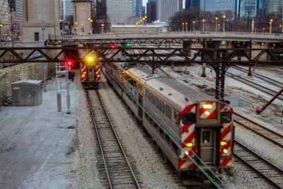
"Metra’s Board of Directors is preparing to approve a policy for adding new stations and closing down existing stations that could potentially slash the number of South Side stations," reports Igor Studenkov.
"The preliminary draft of the station evaluation policy was released for public comment following the railroad’s March 2019 board meeting. The board expects to approve the policy during its May 15 meeting, when 2018 ridership numbers will be released," according to Studenkov.
According to Studenkov's analysis of the evaluation policy, the South Side is likely to bear the brunt of any station reductions. "The Metra Electric Line’s Blue Island branch could lose all of its Chicago stations, effectively removing all rail service from the West Pullman and Roseland communities," for instance. Studenkov also explains how the new policy will speed up the process for closing stations.
On the other side of the equation, adding stations, Studenkov notes that the process requires a paid sponsor to fund the study required to plan and build a new station.
In 2017, Metra made news for cutting service to the South Side, contributing to a narrative implied here that Metra is in the process of abandoning much of its service on the South Side of Chicago.
FULL STORY: Metra Considers a New Policy for Adding Infill Stations, Closing Low-Ridership Stops


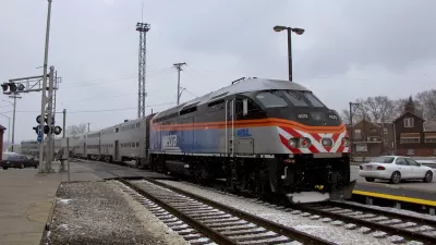
Metra North Central Service Line Riders Push for More Service
A new report imagines more robust service on one of Metra's regional commuter lines in Chicago.
Another New Commuter Rail Station for Chicago's South Side Transit Deserts
A South Side Chicago neighborhood with a history of neglect and disinvestment will soon be adding a new train station on the regional commuter system.
Chicago Transit Agencies on Brink of Major Crisis
Without additional funding, regional transit agencies will be forced to cut services by 40 percent.

Maui's Vacation Rental Debate Turns Ugly
Verbal attacks, misinformation campaigns and fistfights plague a high-stakes debate to convert thousands of vacation rentals into long-term housing.

Planetizen Federal Action Tracker
A weekly monitor of how Trump’s orders and actions are impacting planners and planning in America.

In Urban Planning, AI Prompting Could be the New Design Thinking
Creativity has long been key to great urban design. What if we see AI as our new creative partner?

Florida Seniors Face Rising Homelessness Risk
High housing costs are pushing more seniors, many of them on a fixed income, into homelessness.

Massachusetts Budget Helps Close MBTA Budget Gap
The budget signed by Gov. Maura Healey includes $470 million in MBTA funding for the next fiscal year.

Milwaukee Launches Vision Zero Plan
Seven years after the city signed its Complete Streets Policy, the city is doubling down on its efforts to eliminate traffic deaths.
Urban Design for Planners 1: Software Tools
This six-course series explores essential urban design concepts using open source software and equips planners with the tools they need to participate fully in the urban design process.
Planning for Universal Design
Learn the tools for implementing Universal Design in planning regulations.
Gallatin County Department of Planning & Community Development
Heyer Gruel & Associates PA
JM Goldson LLC
City of Camden Redevelopment Agency
City of Astoria
Transportation Research & Education Center (TREC) at Portland State University
Jefferson Parish Government
Camden Redevelopment Agency
City of Claremont