


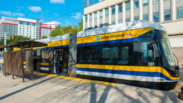
Dallas' street car lines were extensive before the age of the private car.

Artist Jake Berman created a map showing the extent of Dallas’s once great streetcar system. This map includes connections from the heart of the city to further out metropolises in regions like Coriscana, Waco, Denton, and Fort Worth and a network of lines traversing the city. “In fact, the new map looks like a rendering of future dreams for Dallas transit–a way to get around the inner city and plan dense development around trafficked transit corridors,” Peter Simek writes for D Magazine.
Anyone who has seen Who Framed Roger Rabbit is likely familiar with the conspiracy theories regarding the death of the streetcar. But, while car manufacturers certainly didn’t lose any sleep over the death of the streetcar, they mostly harmed it by causing the traffic that slowed it down. These slower streets, couldn’t support the then privately-owned streetcars. “By the time cities took control of the streetcars, cars had caught on and streets were crowded with traffic that slowed the lines. Service suffered. Ridership fell,” Simek writes.
“Nonetheless, looking at this revamped old map, it is difficult not to daydream about what kind of city Dallas could have been if we kept and built around the streetcar system,” Simek writes. This was Berman’s intent.
FULL STORY: Dallas Public Transit Was Better in 1919 Than It Is in 2019

Texas State Bills to Defund Dallas Transit Die
DART would have seen a 30% service cut, $230M annual losses had the bills survived.
Dallas Ditches Parking Minimums in 14-1 Vote
The sweeping city council decision removes set parking requirements from developments downtown, near transit, small businesses and more.

DARTSpace Platform Streamlines Dallas TOD Application Process
The Dallas transit agency hopes a shorter permitting timeline will boost transit-oriented development around rail stations.

Maui's Vacation Rental Debate Turns Ugly
Verbal attacks, misinformation campaigns and fistfights plague a high-stakes debate to convert thousands of vacation rentals into long-term housing.

Planetizen Federal Action Tracker
A weekly monitor of how Trump’s orders and actions are impacting planners and planning in America.

In Urban Planning, AI Prompting Could be the New Design Thinking
Creativity has long been key to great urban design. What if we see AI as our new creative partner?

King County Supportive Housing Program Offers Hope for Unhoused Residents
The county is taking a ‘Housing First’ approach that prioritizes getting people into housing, then offering wraparound supportive services.

Researchers Use AI to Get Clearer Picture of US Housing
Analysts are using artificial intelligence to supercharge their research by allowing them to comb through data faster. Though these AI tools can be error prone, they save time and housing researchers are optimistic about the future.

Making Shared Micromobility More Inclusive
Cities and shared mobility system operators can do more to include people with disabilities in planning and operations, per a new report.
Urban Design for Planners 1: Software Tools
This six-course series explores essential urban design concepts using open source software and equips planners with the tools they need to participate fully in the urban design process.
Planning for Universal Design
Learn the tools for implementing Universal Design in planning regulations.
planning NEXT
Appalachian Highlands Housing Partners
Mpact (founded as Rail~Volution)
City of Camden Redevelopment Agency
City of Astoria
City of Portland
City of Laramie