


All aboard.
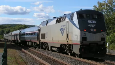
Dan Malouf shares an animation created by Will Geary using data from Transitland (an open-source data service project sponsored by Mapzen). The animation was actually created a year ago, but worth looking at again (and again).
"This animation shows how every Amtrak train in America is scheduled to move, over the course of one typical week," explains Malouf.
"Watching the animation run, it appears as though three separate systems run at the same time, almost independent of each other: The Northeast Corridor from Boston to Washington, the midwest's “Chicago hub,” and the west coast. Meanwhile, the south and interior west see trains few and far between."
Will Geary also wrote a blog post on the Mapzen website that explains more about how he created the animation. Animations for specific cities are also available.
FULL STORY: See a week of Amtrak trips on one animated map

Amtrak Planning Extensive Service Cuts
The disappointment of 2020 has hit Amtrak particularly hard.

The Subversive Car-Free Guide to Trump's Great American Road Trip
Car-free ways to access Chicagoland’s best tourist attractions.

Five Key Transportation Funding Proposals in Trump’s Budget
The President’s proposed 2026 budget would keep spending roughly the same for transit and rail and eliminate over $5 billion in funding for EV charging infrastructure.

Maui's Vacation Rental Debate Turns Ugly
Verbal attacks, misinformation campaigns and fistfights plague a high-stakes debate to convert thousands of vacation rentals into long-term housing.

Planetizen Federal Action Tracker
A weekly monitor of how Trump’s orders and actions are impacting planners and planning in America.

In Urban Planning, AI Prompting Could be the New Design Thinking
Creativity has long been key to great urban design. What if we see AI as our new creative partner?

King County Supportive Housing Program Offers Hope for Unhoused Residents
The county is taking a ‘Housing First’ approach that prioritizes getting people into housing, then offering wraparound supportive services.

Researchers Use AI to Get Clearer Picture of US Housing
Analysts are using artificial intelligence to supercharge their research by allowing them to comb through data faster. Though these AI tools can be error prone, they save time and housing researchers are optimistic about the future.

Making Shared Micromobility More Inclusive
Cities and shared mobility system operators can do more to include people with disabilities in planning and operations, per a new report.
Urban Design for Planners 1: Software Tools
This six-course series explores essential urban design concepts using open source software and equips planners with the tools they need to participate fully in the urban design process.
Planning for Universal Design
Learn the tools for implementing Universal Design in planning regulations.
planning NEXT
Appalachian Highlands Housing Partners
Mpact (founded as Rail~Volution)
City of Camden Redevelopment Agency
City of Astoria
City of Portland
City of Laramie