


The Wine Country wildfires destroyed Coffey Park, a subdivision within the urban boundaries of the Bay Area's fifth largest city, and outside of the state's severe fire hazard zones. But the cause wasn't a mystery to wildland fire scientists.

The Wine Country wildfires began on Sunday night, Oct. 8. One of its first major casualties of the Tubbs Fire was Coffey Park, "a compact subdivision of modest single-family homes built decades ago," reported Robert Digitale for The (Santa Rosa) Press Democrat on Oct. 9. The Associated Press called the neighborhood "Ground Zero for California fire devastation" on Oct. 14.
Watch a video taken from the SMART train as it goes through Coffey Park. Note the presence of trees, particularly the ones with their foliage intact, and the absence of structures in the conflagration.
The subdivision's location, within the northern boundaries of Santa Rosa, the county seat of Sonoma County, is outside the fire hazard severity zones mapped by the California Department of Forestry and Fire Protection (CAL FIRE), which made it an odd candidate for such destruction, although it is within the wildland-urban interface as drawn by at least one firm.
"The fire hazard zone shown on city and state maps was to the north and east, on the other side of the 101 Freeway," report Doug Smith and Nina Agrawal for the Los Angeles Times on Oct. 15.
“We live in a subdivision in the middle of freaking Santa Rosa,” said Anna Brooner, whose house still stands on the side of Randon Way that didn’t burn, facing a scene of rubble and ash oddly punctuated by street trees that still have leaves and a plastic recycling bin that didn’t melt.
“I could see living on the outskirts of the mountains, you always have the potential of fire,” Brooner said. “But you would never expect it in a subdivision of this size.”
Those trees help wildland fire scientists understand what made Coffey Park vulnerable to the wild fire. The subdivision was the victim of an urban fire, caused by a wildfire.
They view it as a rare, but predictable, event that has exposed flaws in the way fire risk is measured and mitigated in California. Because it was outside the officially mapped “very severe” hazard zone, more than five miles to the east, Coffey Park was exempt from regulations designed to make buildings fire resistant in high-risk areas.
Though a forensic examination will be required to understand exactly what happened at Coffey Park, the unburned trees still standing in the neighborhood tell wildland fire experts that the cause was not a giant front of flames sweeping out of the nearby hills and fields.
Most likely, the fire was touched off by embers blown from a distance. Firebrands capable of igniting a house can travel more than a mile.
Fire experts surmise that most of the damage was caused by fire spreading from house to house, leaving some parkway trees and things like trash cans oddly unscathed
FULL STORY: Despite clear risks, Santa Rosa neighborhood that burned down was exempt from state fire regulations


Wine Country Wildfires Put Spotlight on Transmission Lines
No cause has yet been attributed to California's deadliest wildfires, but the connections to fallen power lines and exploding transformers, maintained by PG&E, have been exposed in a series of reports by the Bay Area News Group.
Complying With New State Laws on ADUs No Easy Matter
Santa Rosa is struggling to complying with two laws passed last year to encourage construction of inlaw units to increase affordable housing. Council members are concerned that loosened restrictions would degrade neighborhood character.
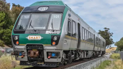
New Commuter Train Comes Through for Fire-Ravaged Santa Rosa
Sonoma-Marin Rail Transit (SMART) has been operating almost continuously at full schedule, collecting no fares since the epic wildfires began in Sonoma County on Oct. 8. Two stations in the fire-zone are shut down due to lack of access.

Maui's Vacation Rental Debate Turns Ugly
Verbal attacks, misinformation campaigns and fistfights plague a high-stakes debate to convert thousands of vacation rentals into long-term housing.

Planetizen Federal Action Tracker
A weekly monitor of how Trump’s orders and actions are impacting planners and planning in America.

In Urban Planning, AI Prompting Could be the New Design Thinking
Creativity has long been key to great urban design. What if we see AI as our new creative partner?

King County Supportive Housing Program Offers Hope for Unhoused Residents
The county is taking a ‘Housing First’ approach that prioritizes getting people into housing, then offering wraparound supportive services.

Researchers Use AI to Get Clearer Picture of US Housing
Analysts are using artificial intelligence to supercharge their research by allowing them to comb through data faster. Though these AI tools can be error prone, they save time and housing researchers are optimistic about the future.

Making Shared Micromobility More Inclusive
Cities and shared mobility system operators can do more to include people with disabilities in planning and operations, per a new report.
Urban Design for Planners 1: Software Tools
This six-course series explores essential urban design concepts using open source software and equips planners with the tools they need to participate fully in the urban design process.
Planning for Universal Design
Learn the tools for implementing Universal Design in planning regulations.
planning NEXT
Appalachian Highlands Housing Partners
Mpact (founded as Rail~Volution)
City of Camden Redevelopment Agency
City of Astoria
City of Portland
City of Laramie