


A new map reveals the scale of the food desert challenge in Cleveland and environs.
Ginger Christ reports that as many as 450,000 people in Cuyahoga County, Ohio live in a food desert, lacking convenient access to healthy food and suffering from higher risks of chronic disease.
The recently released Cuyahoga County Supermarket Assessment mapped the county's food deserts to illustrate the scale of the problem, including neighborhoods in the city of Cleveland and its suburbs, and overlays the food desert map with demographic data. According to Christ, the project identifies "about 20 spots in the county, in areas such as Glenville and Bedford Heights, where access to healthy food is the most difficult."
While the article is able to report the recent opening of a supermarket in Euclid, details about the efforts of the Cuyahoga County Board of Health's Creating Healthy Communities program are lacking in the article. The county's program is made possible by funding from the Ohio Department of Health, and more information is available online and in the video found below.
FULL STORY: As many as 450,000 people in the county live in food deserts; group wants to increase access to supermarkets

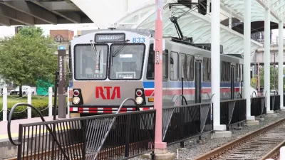
Study: Cuyahoga County Suburbs Ready for TOD
The growth of transit-oriented development in the Cleveland region is being hindered by zoning codes that limit housing density and excessive parking requirements that drive up construction costs, new research suggests.

Freeway Cap Park Proposed in the Heart of Cleveland
A proposal to cap part of the Innerbelt Freeway east of Downtown Cleveland would require the demolition of a vacant, historic courthouse near the East 22nd Street Bridge.

Another State (Ohio) Gets It Right
Washington and California have been praised for early efforts to mitigate community spread of the novel coronavirus, resulting in relatively low rates of infection, hospitalization, and ultimately, death. Add Ohio to the bunch.

Maui's Vacation Rental Debate Turns Ugly
Verbal attacks, misinformation campaigns and fistfights plague a high-stakes debate to convert thousands of vacation rentals into long-term housing.

Planetizen Federal Action Tracker
A weekly monitor of how Trump’s orders and actions are impacting planners and planning in America.

San Francisco Suspends Traffic Calming Amidst Record Deaths
Citing “a challenging fiscal landscape,” the city will cease the program on the heels of 42 traffic deaths, including 24 pedestrians.

Defunct Pittsburgh Power Plant to Become Residential Tower
A decommissioned steam heat plant will be redeveloped into almost 100 affordable housing units.

Trump Prompts Restructuring of Transportation Research Board in “Unprecedented Overreach”
The TRB has eliminated more than half of its committees including those focused on climate, equity, and cities.

Amtrak Rolls Out New Orleans to Alabama “Mardi Gras” Train
The new service will operate morning and evening departures between Mobile and New Orleans.
Urban Design for Planners 1: Software Tools
This six-course series explores essential urban design concepts using open source software and equips planners with the tools they need to participate fully in the urban design process.
Planning for Universal Design
Learn the tools for implementing Universal Design in planning regulations.
Heyer Gruel & Associates PA
JM Goldson LLC
Custer County Colorado
City of Camden Redevelopment Agency
City of Astoria
Transportation Research & Education Center (TREC) at Portland State University
Jefferson Parish Government
Camden Redevelopment Agency
City of Claremont