


Does compact development cause higher rents? No.

One common argument against new housing in urban areas is that new housing equals densification, and dense places are less affordable. For example, pro-sprawl commentator Wendell Cox writes that “There is a strong correlation between urban density and housing affordability, such that affordability is better where urban densities are lower.”
Cox has a point in this respect: some of the nation’s densest cities (most notably New York, Boston and San Francisco) are among the most expensive.
But if correlation and causation were the same thing, we would find that as cities grew less dense, housing became cheaper. But as Cox himself has argued, most American regions (and many other large cities around the world) have grown less dense over time. If sprawl means more affordability, where are the big savings?
For example, even though New York City as a whole has grown over the decades, most of that growth occurred in the outer boroughs. Manhattan’s population declined from 2.3 million in 1910 to just under 1.7 million in 2020, while the rest of the city grew from 2.4 million to 6.1 million. But as Manhattan grew less dense, its rents kept growing. Sale prices rose from $8 per square foot (or about $230 in today’s dollars) to $1142 today, and average rents grew from $40 per month (roughly $1200 in modern dollars) to over $3500 today. If sprawl led to lower rents, Manhattan rents would have gone down. Where are the big savings? Where?
So how do I explain the correlation between density and housing costs? First, higher housing costs may actually cause higher densities under some circumstances. If land and housing are expensive, some people may be willing to settle for less of it: people who might otherwise prefer big houses buy or rent smaller ones in expensive cities, and people who might other prefer big apartments settle for smaller ones. (On the other hand, this effect is at least partially canceled out by people who choose to move to less expensive places).
Second, high rents reflect the law of supply and demand, and the most dense big cities (at least in the U.S.) have not added as much housing supply in recent years as some not-so-dense cities. The most expensive U.S. regions are notorious for being stingy with building permits, while cities that have added lots of new housing are less expensive.
Although not all regions with dense cities are expensive,* it might be more politically difficult to add new housing in a dense city where almost any tract of land has neighbors who might fear new development. And because dense cities have less vacant land, building new housing might require tearing down existing structures, which could be costly or politically controversial.
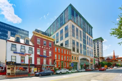
*In particular, New York, San Francisco and Boston are the most dense major cities in the US, and are extremely expensive. On the other hand, Chicago (the fourth most dense city with over 500,000 residents) and Philadelphia (the fifth most dense) are far less expensive.


Planetizen Federal Action Tracker
A weekly monitor of how Trump’s orders and actions are impacting planners and planning in America.

Map: Where Senate Republicans Want to Sell Your Public Lands
For public land advocates, the Senate Republicans’ proposal to sell millions of acres of public land in the West is “the biggest fight of their careers.”

Restaurant Patios Were a Pandemic Win — Why Were They so Hard to Keep?
Social distancing requirements and changes in travel patterns prompted cities to pilot new uses for street and sidewalk space. Then it got complicated.

Platform Pilsner: Vancouver Transit Agency Releases... a Beer?
TransLink will receive a portion of every sale of the four-pack.

Toronto Weighs Cheaper Transit, Parking Hikes for Major Events
Special event rates would take effect during large festivals, sports games and concerts to ‘discourage driving, manage congestion and free up space for transit.”

Berlin to Consider Car-Free Zone Larger Than Manhattan
The area bound by the 22-mile Ringbahn would still allow 12 uses of a private automobile per year per person, and several other exemptions.
Urban Design for Planners 1: Software Tools
This six-course series explores essential urban design concepts using open source software and equips planners with the tools they need to participate fully in the urban design process.
Planning for Universal Design
Learn the tools for implementing Universal Design in planning regulations.
Heyer Gruel & Associates PA
JM Goldson LLC
Custer County Colorado
City of Camden Redevelopment Agency
City of Astoria
Transportation Research & Education Center (TREC) at Portland State University
Camden Redevelopment Agency
City of Claremont
Municipality of Princeton (NJ)