


Technology
Sandy Inspires Solar Companies to Rework System
Hurricane Sandy caused power outages that also prevented the use of hundreds of solar panels in the greater New York area. Solar companies are now working on decentralizing the system to make solar energy a backup source, reports Diane Cardwell.
Preserving History, Byte by Byte
Completed in 1791, the Mission Dolores is the oldest building in San Francisco. It has survived major earthquakes in the past, writes Alexis Coe, but preservationists are worried about its fate and have begun digitally preserving the landmark.
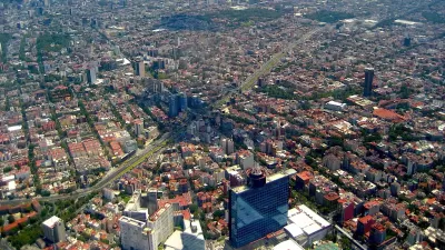
The Secret Plans for Containing New York's Next Housing Emergency
Hurricane Sandy exposed the need for New York City to be able to house large numbers of residents following natural disasters. Matt Chaban examines the Bloomberg administration's "secret" plan to build modular apartments out of shipping containers.

Why Do Americans Put Up With Decaying Infrastructure?
Compared to Europe's high-speed rail, paved roads, and underground power lines, America lags behind with its unreliable trains, potholes, and overhead power lines. Uwe E. Reinhardt questions why Americans put up with the decaying infrastructure.
With a Little Help From Their Dutch Friends, Could New York Become New Amsterdam?
“In recent days, the Netherlands’ peerless expertise and centuries of experience in battling water have been widely hailed in the United States as offering lessons" for New York and for other cities alike, writes Andrew Higgins.
Copenhagen Tops List of Europe's Smartest Cities
Based on a new metric he's developed for defining the components of a smart city, Boyd Cohen ranks the top cities in Europe that are "working the hardest to be the most advanced urban landscape."
Chinese Government Responds to Growing NIMBYism
For the last 30 years, China has led the world in economic growth at a hefty environmental price. Widespread protests have prompted the cabinet of China to mandate a "social risk assessment" for industrial projects, reports Keith Bradsher.

Planetizen's Responsive Redesign
We have completely redesigned and rebuilt the Planetizen website. Enjoy the new features, a fresh new look, and a streamlined mobile-friendly design that's optimized for your laptop, tablet, and smartphone.
Small Cities Get Smart
A new web-based software, described as a "Google Analytics for local governments," allows smaller cities to get involved in the Gov 2.0 revolution, reports Ariel Schwartz.
Social Media Becomes Force for Improving Developing Cities
Luis Alberto Moreno explores how Facebook and Twitter are improving cities in the developing world, as the governments of many Latin American municipalities take advantage of the explosive growth of social media to engage with citizens.
New App Explores Ecological Urbanism
A new interactive app produced by the Harvard Graduate School of Design (GSD) and Second Story Interactive Studios compiles and exhibits examples of "alternative and radical approaches to sustainability at a range of urban scales."
Iskandar Malaysia: The Future of Urban Living or Pipe Dream?
Across the strait from Singapore, Iskandar Malaysia is being planned as the world’s next eco mega-city. Its architects and developers hope it will offer an alternative to Asia's polluted cities and a glimpse of the future of urban living.
Should New York Build Sea Barriers?
As NYC struggles to cope with the damage from Superstorm Sandy, officials and experts are revisiting the possibility of building, at great cost, a protective barrier around its coast.
Legalizing Green Design
Across America, arcane zoning regulations and building codes prevent some of the most promising sustainable techniques and technologies from being built. A project based in Oregon aims to make land use regulations friendlier for greener building.
How Traffic Data At Your Fingertips Can Create Smarter Cities
What do recent national politics have to do with transportation planning? For Sarah Goodyear, the connection is clear: it's about having access to good data for solving real-world problems.
Dutch Designers Reinvent the Road
You may have heard about smart cars, but what about smart streets? A plan for modernizing European highways has been generating a lot of buzz from civil engineers worldwide, reports Kelsey Campbell-Dollaghan.
New Technology Helps Your Community Prepare for the Next Disaster
Ariel Schwartz explains Recovers, "a logistical management system for disaster recovery," that gives communities tools for matching volunteers with recovery tasks, in the event of a disaster.
One Government Agency You Don't Second Guess
One silver lining from Hurricane Sandy is that it proved the accuracy of the National Hurricane Center, an agency under the National Oceanic and Atmospheric Administration (NOAA) due largely to its hi-tech tools. Do you know what a 'dropsonde' is?
Planes that Run on Natural Gas
Qatar Airlines is gearing up their jets to run on a fuel derived from natural gas - so don't expect to see fuel tanks holding liquefied gas. Similar to the "Messerschmitt Fuel" in World War II that was derived from coal, they are called synfuels.
LEED Certification: Path to Better Buildings or Bigger Bottom Lines?
With supporting evidence from a USA TODAY analysis, Thomas Frank examines the LEED points system and finds that certification, and the tax breaks and other rewards that go with it, can be easily obtained without proven environmental impact.
Urban Design for Planners 1: Software Tools
This six-course series explores essential urban design concepts using open source software and equips planners with the tools they need to participate fully in the urban design process.
Planning for Universal Design
Learn the tools for implementing Universal Design in planning regulations.
Heyer Gruel & Associates PA
JM Goldson LLC
Custer County Colorado
City of Camden Redevelopment Agency
City of Astoria
Transportation Research & Education Center (TREC) at Portland State University
Jefferson Parish Government
Camden Redevelopment Agency
City of Claremont


