


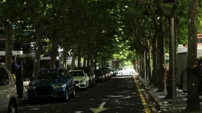
You may have heard about smart cars, but what about smart streets? A plan for modernizing European highways has been generating a lot of buzz from civil engineers worldwide, reports Kelsey Campbell-Dollaghan.
With their Smart Highway plan, Dutch designer Daan Roosegaarde and civil engineers Heijmans Infrastructure are seeking to modernize a technology that has remained largely unchanged since asphalt was introduced in the late 19th century.
"We live in a city of endless gray concrete roads, surrounded by steel lamps. They have a huge visual impact on our city," says Roosegaarde. "But why do they remain so rough and without imagination? Why not make them a vision about mobility, a symbol of the future?"
"The Smart Highway isn't a completely new road, but rather, a kit of parts that can be applied to existing roads as needed," says Campbell-Dollaghan. "The group's plan proposes embedding highways with technology that can visually communicate when the road is slippery, charge your car as you drive, and generate electricity for its own lights. While it remains conceptual, the plan gained considerable momentum this week after it received a Dutch Design Award."
"Asked about how much smart highways will cost, Roosegarde jokes, 'it would be more expensive than a current road, but less expensive than building a new planet Earth.'"
FULL STORY: Smart Cars, Pshaw: Dutch Designers Aim To Reinvent The Highway

Research: More Complex Streets Are Safer
Streets that offer more perceived obstacles and distractions can force drivers to slow down and drive more carefully.

‘Complete Streets’ Webpage Deleted in Federal Purge
Basic resources and information on building bike lanes and sidewalks, formerly housed on the government’s Complete Streets website, are now gone.

Has Progress on Travel Safety Run Off the Road?
Changing technology and rebuilding infrastructure to improve road safety are long-term strategies. How can enforcement and interventions that influence driver behavior make a difference in reducing traffic deaths sooner?

Maui's Vacation Rental Debate Turns Ugly
Verbal attacks, misinformation campaigns and fistfights plague a high-stakes debate to convert thousands of vacation rentals into long-term housing.

Planetizen Federal Action Tracker
A weekly monitor of how Trump’s orders and actions are impacting planners and planning in America.

In Urban Planning, AI Prompting Could be the New Design Thinking
Creativity has long been key to great urban design. What if we see AI as our new creative partner?

King County Supportive Housing Program Offers Hope for Unhoused Residents
The county is taking a ‘Housing First’ approach that prioritizes getting people into housing, then offering wraparound supportive services.

Researchers Use AI to Get Clearer Picture of US Housing
Analysts are using artificial intelligence to supercharge their research by allowing them to comb through data faster. Though these AI tools can be error prone, they save time and housing researchers are optimistic about the future.

Making Shared Micromobility More Inclusive
Cities and shared mobility system operators can do more to include people with disabilities in planning and operations, per a new report.
Urban Design for Planners 1: Software Tools
This six-course series explores essential urban design concepts using open source software and equips planners with the tools they need to participate fully in the urban design process.
Planning for Universal Design
Learn the tools for implementing Universal Design in planning regulations.
planning NEXT
Appalachian Highlands Housing Partners
Mpact (founded as Rail~Volution)
City of Camden Redevelopment Agency
City of Astoria
City of Portland
City of Laramie