


The hulking structures proposed to handle UberAIR's fleet of flying taxis won't be able to serve 4,000 passengers per hour. And that's just one of their many deficiencies, Alissa Walker writes.

Alissa Walker excoriates a set of designs for the "skyports" Uber wants to install in cities to serve UberAIR, its ambitious plan to make autonomous flying taxis a reality. "As they stand now, these hulking structures are essentially just freeway ramps—limited capacity, car-centric infrastructure that would take up a lot of space in our cities but serve only one purpose—and even getting them to work as well as existing freeways will be challenging."
Walker goes through a laundry list of criticisms, beginning with the steep logistical challenges involved. Furthermore, she writes, "this is clearly car-centric infrastructure, even if it's all about the air. Because you will be getting to the UberAIR terminal via your Uber car, of course." The plans tend to locate the hulking skyports next to or over existing freeways.
Another problem: "many of [the designs] appear to be the tallest building in the neighborhoods they serve, and god bless any architect who believes he might be able to convince a homeowners' association on LA's lawsuit-happy Westside to build a small airport on top of a brand-new skyscraper."
Should they ever become a reality, "Uber's skyports should be places that provide a myriad of additional benefits for neighborhoods—and don't create any additional car trips." Of course, this idea is still in its earliest stages, and Uber hasn't yet settled on what kind of VTOL (vertical takeoff and landing) aircraft would work here, if any.
FULL STORY: Uber’s Skyports are just freeway onramps for flying cars

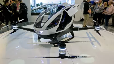
Are You Ready for a Sky Full of Autonomous Flying Taxis?
Some lucky people could be flying over traffic in autonomous drones within two years, according to a media blitz this morning.

A Transit Consultant's Take on Flying Cars
A journalist asked, so Jarrett Walker answered.
Flying Taxi Skepticism
A ride-hailing company that lost $5.2 billion in one quarter wants to launch a flying taxi service. According to this op-ed, cities should concentrate on expanding existing public transit systems instead of wasting time and money on pipe dreams.

Maui's Vacation Rental Debate Turns Ugly
Verbal attacks, misinformation campaigns and fistfights plague a high-stakes debate to convert thousands of vacation rentals into long-term housing.

Planetizen Federal Action Tracker
A weekly monitor of how Trump’s orders and actions are impacting planners and planning in America.

In Urban Planning, AI Prompting Could be the New Design Thinking
Creativity has long been key to great urban design. What if we see AI as our new creative partner?

King County Supportive Housing Program Offers Hope for Unhoused Residents
The county is taking a ‘Housing First’ approach that prioritizes getting people into housing, then offering wraparound supportive services.

Researchers Use AI to Get Clearer Picture of US Housing
Analysts are using artificial intelligence to supercharge their research by allowing them to comb through data faster. Though these AI tools can be error prone, they save time and housing researchers are optimistic about the future.

Making Shared Micromobility More Inclusive
Cities and shared mobility system operators can do more to include people with disabilities in planning and operations, per a new report.
Urban Design for Planners 1: Software Tools
This six-course series explores essential urban design concepts using open source software and equips planners with the tools they need to participate fully in the urban design process.
Planning for Universal Design
Learn the tools for implementing Universal Design in planning regulations.
Appalachian Highlands Housing Partners
Gallatin County Department of Planning & Community Development
Heyer Gruel & Associates PA
Mpact (founded as Rail~Volution)
City of Camden Redevelopment Agency
City of Astoria
City of Portland
City of Laramie